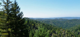
During the last year, Friends of Gualala River (FoGR) and its all-volunteer membership made great strides with countless hours of work to protect the river and advocate for all the plant and animal species that are part of the watershed. We have used our donated monies to continue the battle to stop egregious floodplain logging plans by hiring attorneys and …
Read More »The Latest from FoGR
Update on litigation concerning the Magical Forest, aka the timber harvest plan “Dogwood”
by Jeanne Jackson The Return to Writ on the Dogwood timber harvest plan (THP) was heard Friday Jan. 24, 2020, in Superior Court by Judge Wick. The two matters being considered were “alternatives” and “cumulative impacts.” In a tentative ruling, Judge Wick ruled against FoGR and sided with Cal-Fire. The final ruling from the hearing is due shortly. The one …
Read More »Mill Bend in Conservation Hands
by John Walton In the fall of 2017, the Friends of Gualala River (FoGR) working group considered a proposal to engage the community in a discussion regarding the 112 acre Mill Bend Properties, including the estuary of the river, that had recently been offered for sale for the first time in nearly 70 years. FoGR’s Board suggested presenting the …
Read More »2019 Donors to Friends of Gualala River
We include here a list of donors to Friends of Gualala River (FoGR) throughout 2019. If you join this group for 2020, you’ll enjoy and appreciate the company of others who care about protecting our river. We can guarantee this reward! Allemal Foundation Anonymous Robin Applegarth Barbara Baer Laura Baker Christina Batt Tempra Board Mary Boyvey Ellen Brown Craig Brestrup …
Read More »The “Little” THP – more floodplain logging
Update: The Little THP was approved by the Director of CalFire on September 23, 2021. Gualala Redwoods Timber has submitted another floodplain logging plan (“Little” THP 1-18-095-MEN), in addition to the disputed Dogwood Timber Harvest Plan (“Dogwood” THP 1-15-042-SON), as well as the “Elk” THP 1-19-00098-MEN. Friends of Gualala River (FoGR) is especially concerned with these plans to log 90-100 …
Read More »Wine Moguls Destroy Land And Pay Small Fines As Cost Of Business, Say Activists
by Alastair Bland, Nation Public Radio’s “The Salt,” November 18, 2019 [excerpt:] After California wine industry mogul Hugh Reimers illegally destroyed at least 140 acres of forest, meadow and stream in part to make way for new vineyards sometime last winter, according to a report from state investigators, state officials ordered the Krasilsa Pacific Farms manager to repair and mitigate …
Read More »Redwood Coast Land Conservancy buying 112 acres near Gualala River and regional park
by Mary Callahan, The Press Democrat, November 4, 2019 [excerpt:] A 112-acre swath of land just inside the mouth of the Gualala River, including 13 acres of river frontage adjacent to Gualala Point Regional Park, is on its way to permanent preservation for public recreation and habitat conservation. Long sought by the community to improve public access to the river …
Read More »Intact Forests in the United States: Proforestation Mitigates Climate Change and Serves the Greatest Good
Climate change and its consequences are arguably the biggest existential threat to mankind and life on earth. Any foreseeable levels of reductions in greenhouse gas emissions will not be enough to meet the conservative 2.0º C target that climate scientists say is needed. We need to increase carbon sequestration in existing forests, wetlands and soils. This study points to conserving …
Read More »Forest regs a self-defeating glut
by Paul Mann Mad River Union, June 10, 2016 [excerpt:] Timber industry officials and environmental activists warn that the state’s logging safeguards have become a bureaucratic snarl that can drag out rule-making for a decade and a half and more. Experts say that 43 years after the enactment of the Forest Practice Act, timescales are so out of joint that …
Read More »How a Timber Harvest Plan Works, and How to Comment on THPs – EPIC
The Environmental Protection Information Center (EPIC) provides a wealth of information on forestry issues in northern California, including: How a Timber Harvest Plan (THP) Works, and How to Look up a THP Timber Harvest Plans in California: Review, Tracking, and Comment Writing – THP Workshop Timber Harvest Plans in California – EPIC workshop EPIC is a community based, non-profit organization …
Read More »Elk THP Documents
Update: The Elk THP was withdrawn in 2024 The Elk timber harvest plan (THP 1-19-00098-MEN) was first submitted by Gualala Redwood Timber in June, 2019. The plan calls for logging redwood trees in 157 acres near Elk Prairie, at the confluence of the North Fork and Little North Fork of the Gualala River. 117 acres are selection logging in the …
Read More »CalFire approves third Dogwood THP; legal fight continues
by W. W. Keller August 9, 2019 © copyright 2019, Independent Coast Observer, Gualala, CA reprinted with permission In a letter dated July 31, the California Department of Forestry and Fire Protection or CalFire approved the third controversial Dogwood timber harvest plan stating, “You may begin timber operations proposed in the plan.” But while the letter says that property owner …
Read More »Dogwood THP Documents
The controversial Dogwood timber harvest plan (THP 1-15-042-SON) was filed by Gualala Redwoods, Inc. (now Gualala Redwood Timber LLC) in May, 2015. The plan calls for logging 90~100 year old redwood trees in 300+ acres along 5 miles of the floodplain of the Gualala River. That plan was approved by the California Department of Forestry and Fire protection (CDF, also …
Read More »Our local watershed protection organization: Friends of Gualala River
by Tempra Board Soundings, Summer, 2019 © copyright 2019, The Sea Ranch Association reprinted with permission Friends of Gualala River (FoGR) has been in the news lately for its efforts to compel state agencies to protect sensitive Gualala River watershed habitat from the latest in a series of Timber Harvest Plans (THPs) proposed by the Gualala Redwood Timber (GRT) company. Get …
Read More »Gualala River park idea garners 1,100 signatures
and 3,000 signatures oppose third Dogwood logging plan by W. W. Keller news@mendonoma.com May 31, 2019 © copyright 2019, Independent Coast Observer, Gualala, CA reprinted with permission The Gualala River Park Coalition, a grassroots environmental organization, has collected more than 1,100 signatures from people who would rather turn the Gualala River floodplain into a public park than see its redwoods …
Read More »Students Protecting the Coast
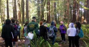
ACORN Partners in Education’s Students Protecting the Coast program with Pacific Community Charter School 6th-8th grade students and Friends of Gualala River.
Read More »Ladies’ Day Steelhead – December, 1915
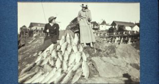
This photo is typical of how it was, back in the day when fishermen could walk across the backs of steelhead and Salmon in the Gualala River. No one considered conservation, because there were so many fish. Unfortunately with habitat degradation and people all killing their limit, things have changed radically. Now that the regulations require catch and release, …
Read More »Dogwood floodplain logging plan, comments by Dr. Peter Baye, May 2019
Comments by Dr. Peter Baye (coastal ecologist, botanist) on the latest version of the “Dogwood” floodplain logging plan (THP 1-15-042-SON): Download & read the entire letter (8 pages, 310 KB) The entire letter is well worth reading, but here’s a short excerpt (not a summary) to whet your appetite: Seasonal wetlands are widespread in the floodplain of the river, …
Read More »Opponents of logging plan along Gualala River dream of expanding park
by Mary Callahan, The Press Democrat, April 25, 2019 [excerpt:] Provoked by a new round of scrutiny over hard-fought plans to harvest timber in the Gualala River floodplain, a contingent of North Coast residents has launched a petition drive to use the land for expansion of a public park instead. It’s the stuff of fantasy for the moment, given the …
Read More »Vision for a Gualala River Park
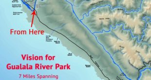
Spanning from bridge to bridge along a wild and scenic river A unique and majestic coastal redwood park with paths wandering along the Gualala River – protected and preserved for this and future generations to visit and enjoy. The park would preserve a seven mile corridor important for wildlife and complete with natural beauty. Public access to world class second …
Read More »-
Won’t back down – Friends of Gualala River continue protection efforts
by Tempra BoardThe Sea Ranch Soundings • Summer 2021 © copyright 2021, The Sea Ranch Associationreprinted with permission Friends of Gualala River (FoGR), our area’s grassroots watershed protection non-profit, continues its hard work defending the Gualala River from the threat of floodplain logging. On May 20, FoGR filed a motion for …
Read More » -
Protecting Endangered Species:
The Case for a Preliminary Injunction -
Gualala River logging project clears hurdle in state court as federal case ramps up
-
Under California cap-and-trade program, North Coast forests turn carbon uptake into cash
by Guy Kovner, The Press Democrat, January 3, 2016 [excerpt:] They say money doesn’t grow on trees, but a nearly 75,000-acre swath of redwood and fir forests blanketing the wildlands of Sonoma and Mendocino counties is generating millions of dollars as it contributes to California’s ambitious campaign to curb greenhouse …
Read More » -
Preservation Ranch saved in record deal – June, 2013, San Francisco Chronicle
-
Sonoma Deal Aims to Combine Logging and Preservation
-
Sonoma County redwood forest spared from conversion into vineyards
 Friends of Gualala River Protecting the Gualala River watershed and the species living within it
