 Friends of Gualala River Protecting the Gualala River watershed and the species living within it
Maps of the Gualala River Watershed
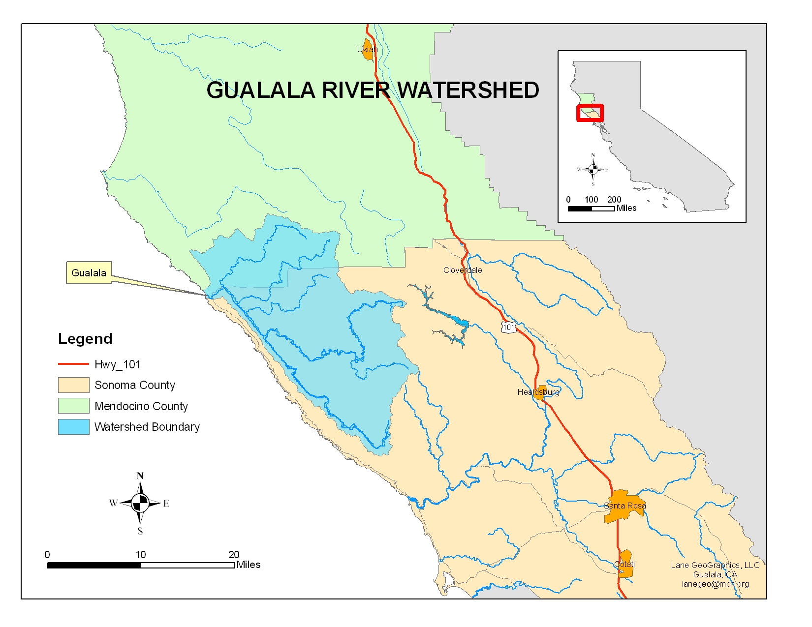
Location of the Gualala River Watershed
Download a larger pdf version
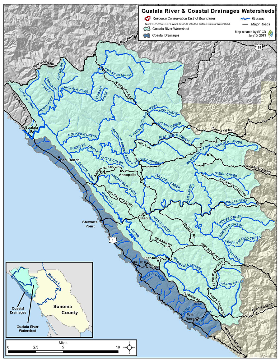
Gualala River & coastal drainages watersheds
map by Sonoma Resource Conservation District
Download a pdf version of this map
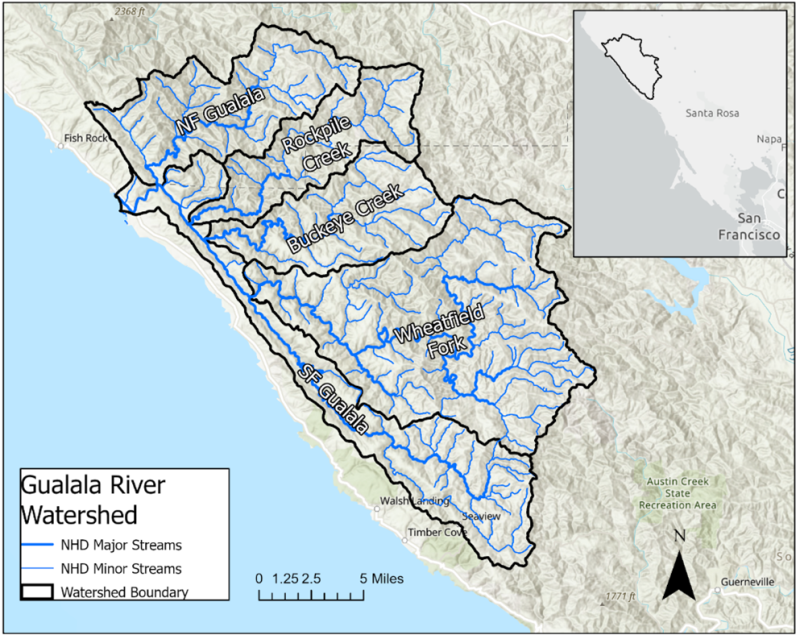
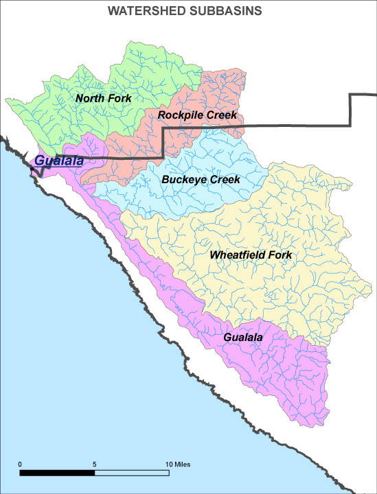
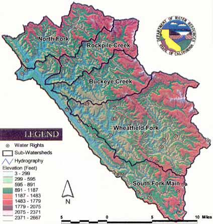
Gualala River sub-watersheds
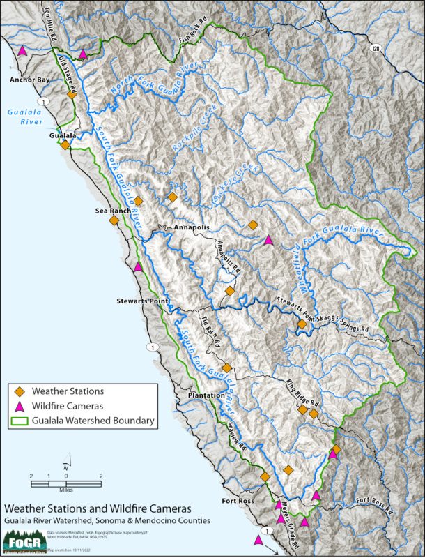
Map of Real-time Weather Stations and Wildfire Cameras
in the Gualala River Watershed
map by Digital Mapping Solutions
Click to visit interactive map
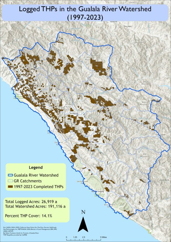
Timber Harvest Plans in the Gualala River Watershed
which completed logging 1997 – 2023
Download a high resolution version of this map
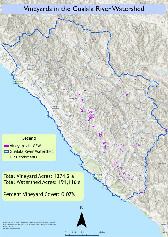
Vineyards in the Gualala River watershed
Download a high resolution version of this map
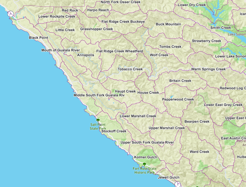
Sub-watersheds in the Sonoma County portion of the Gualala River basin
Download a pdf version of this map
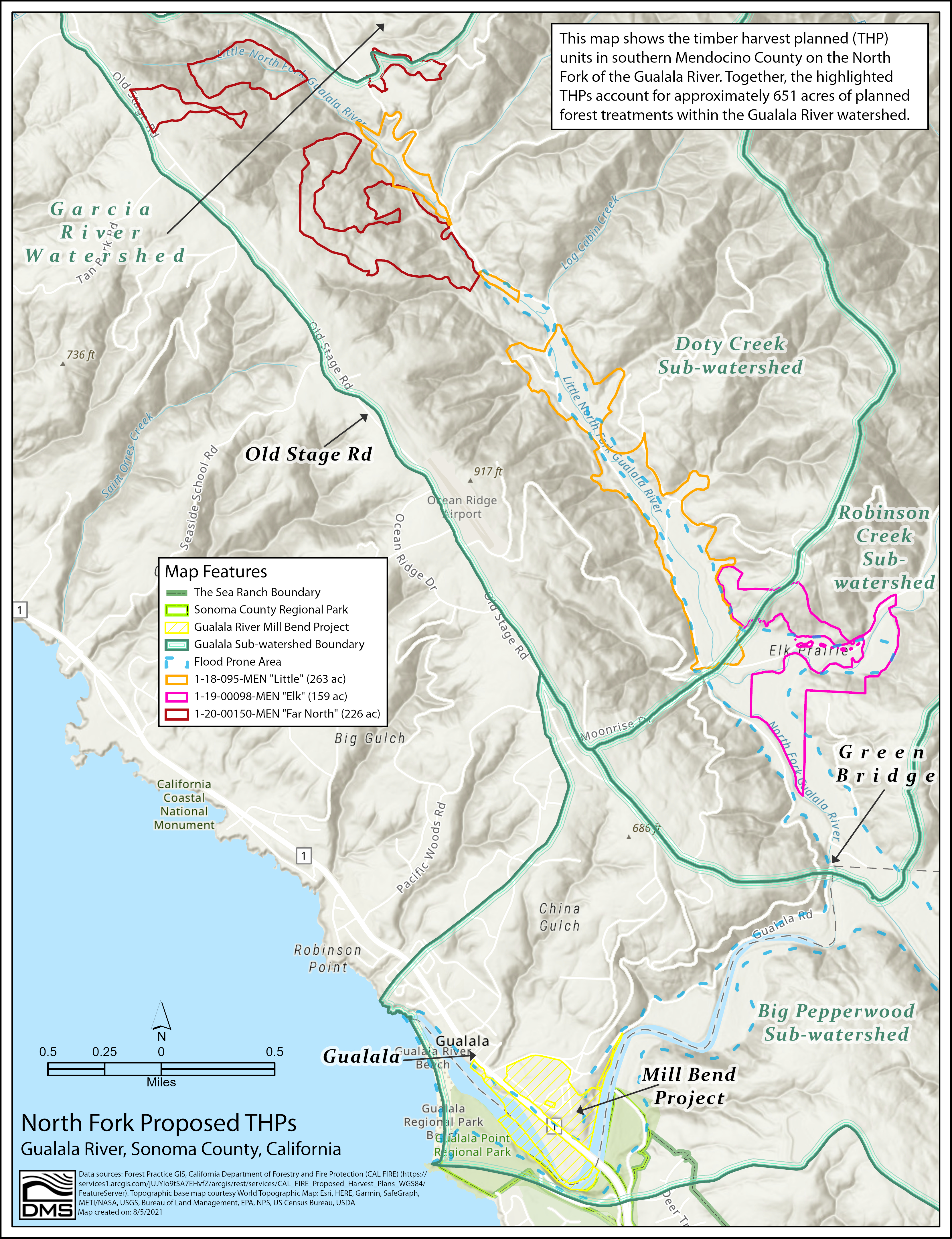
North Fork Gualala River 2021: Three THPs: Little, Elk & Far North
map by Digital Mapping Solutions
Download a high-res pdf version of this map
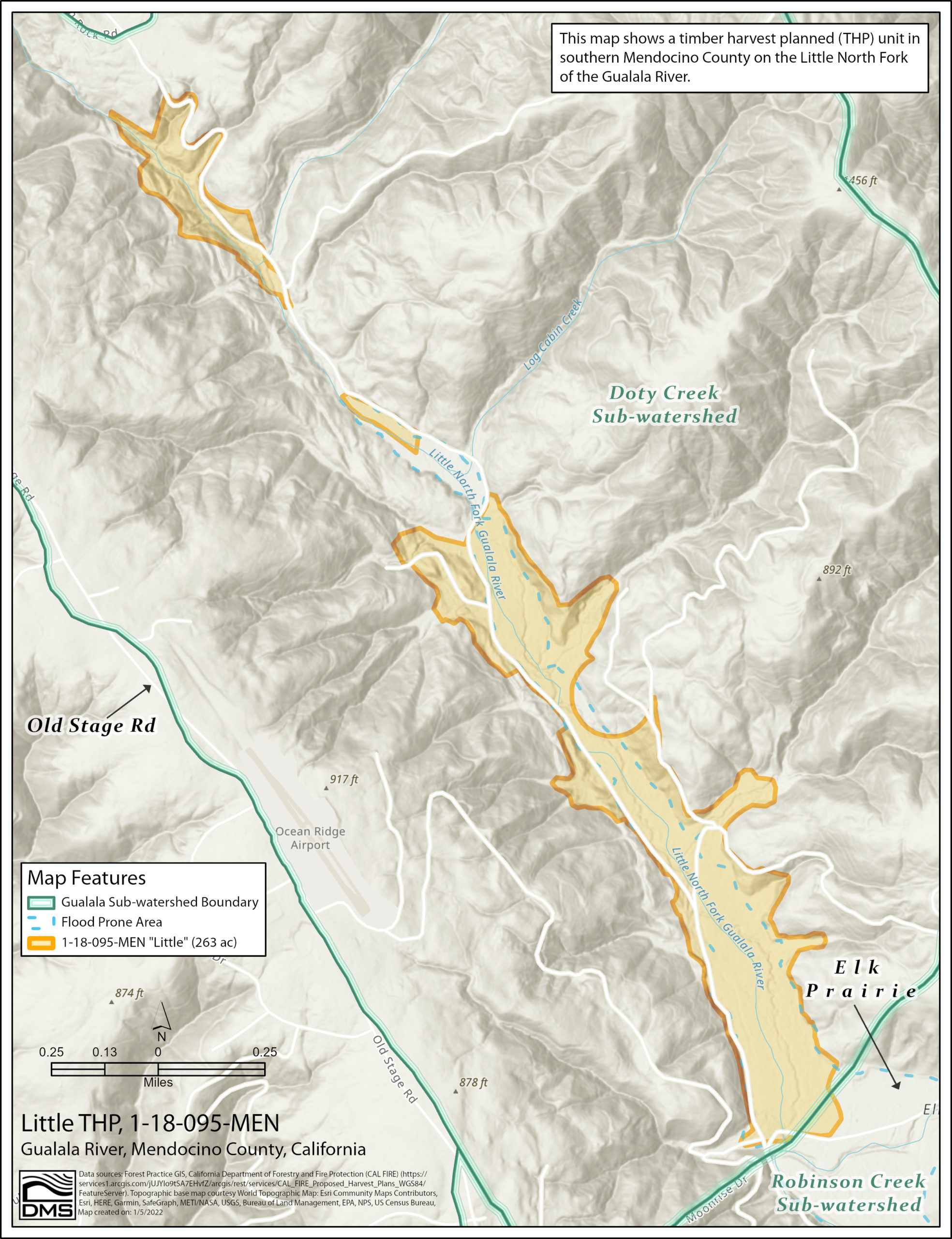
Little THP, 1-18-095-MEN [map by Digital Mapping Solutions]
Download a high-res pdf version of this map

Elk THP, 1-19-00098-MEN [map by Digital Mapping Solutions]
Download a high-res pdf version of this map
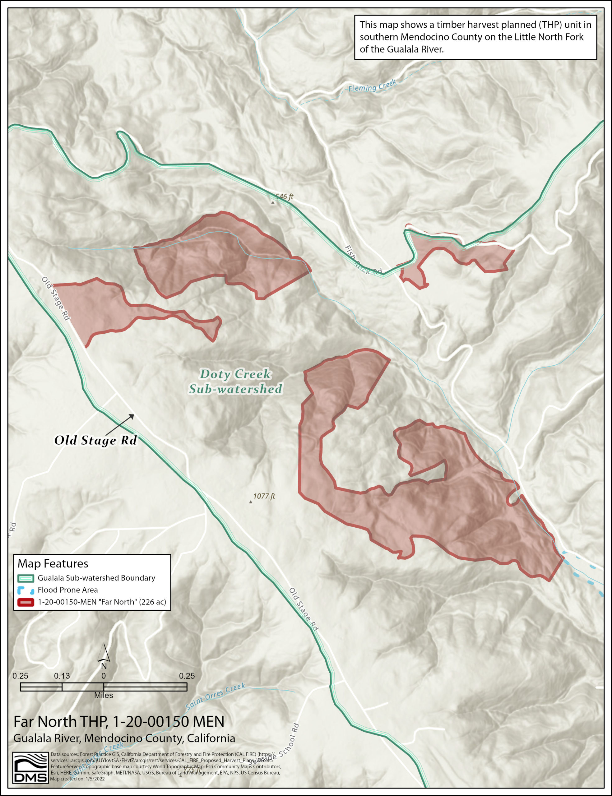
Far North THP, 1-20-00150-MEN [map by Digital Mapping Solutions]
Download a high-res pdf version of this map
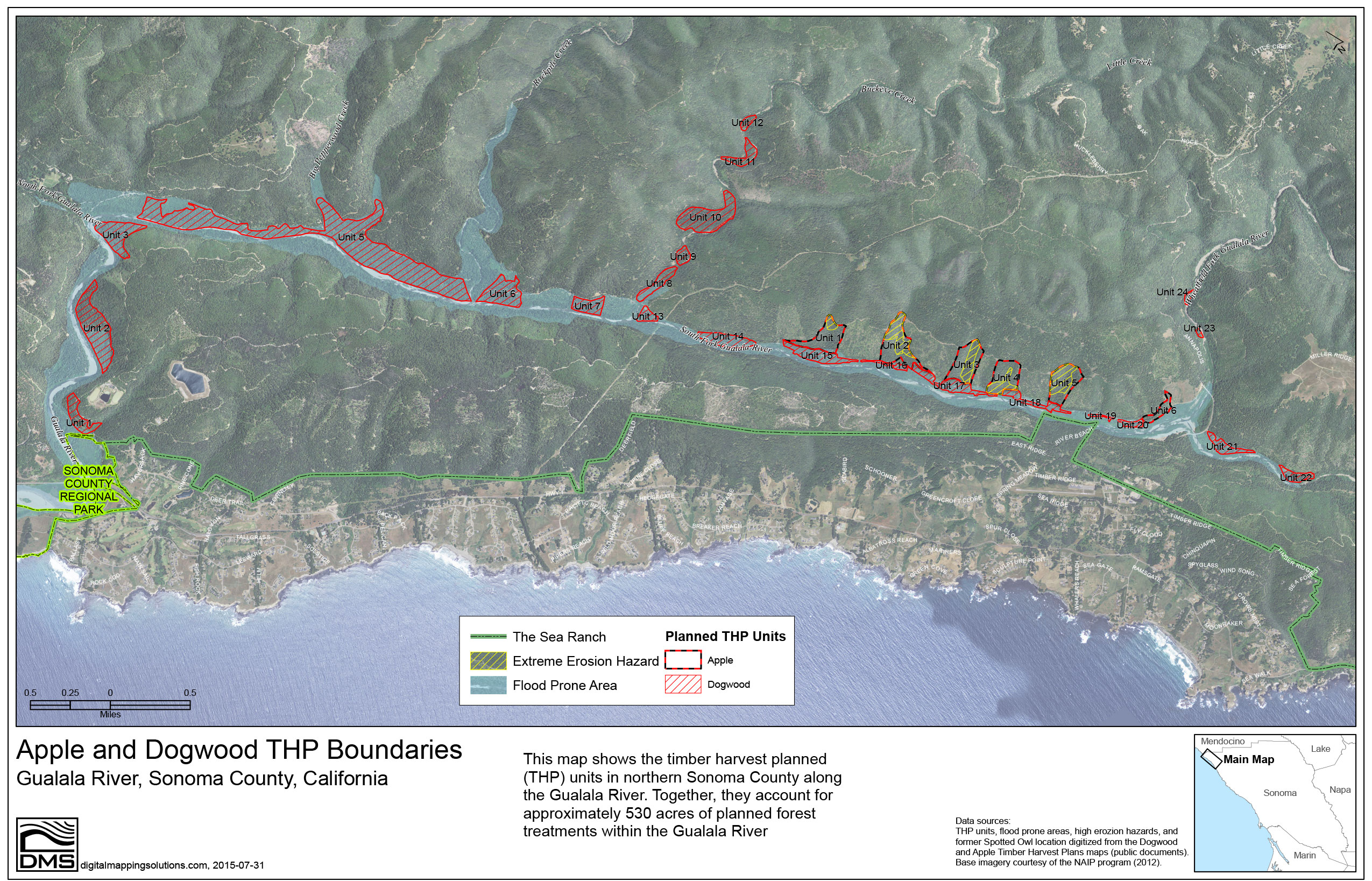
2015 Apple and Dogwood THP Boundaries
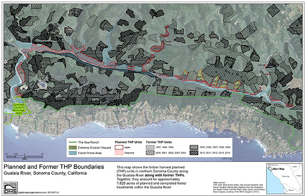
2015 Apple and Dogwood THP Boundaries with Previous THPs
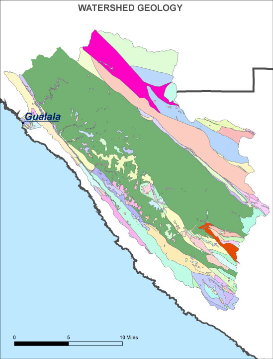
Geology of the Gualala River Watershed

Topography of the Gualala River Watershed
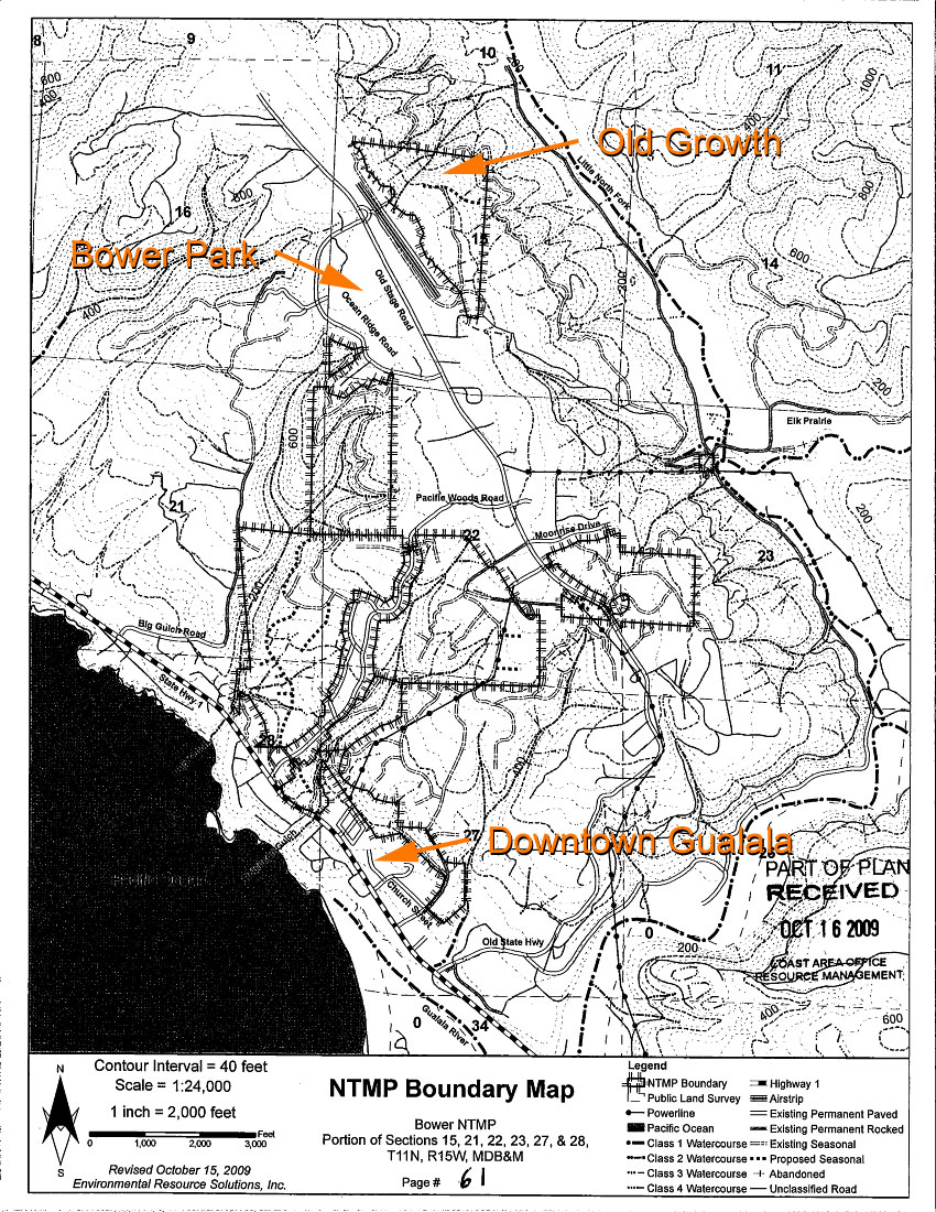
Bower NTMP logging plan, Gualala, CA (1-08NTMP-009 MEN)
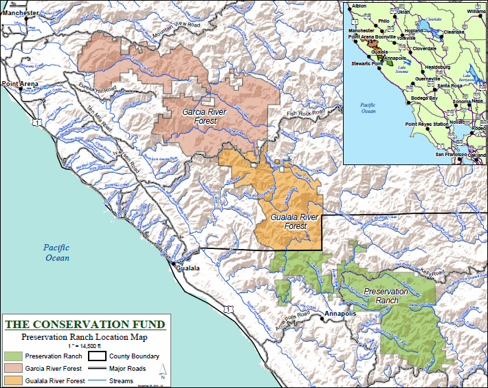
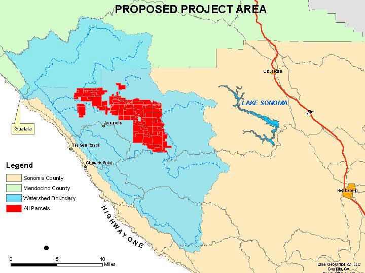
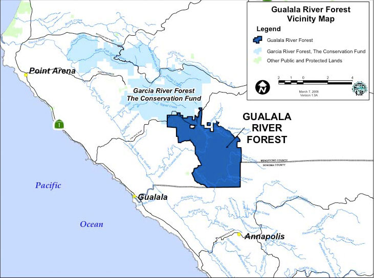
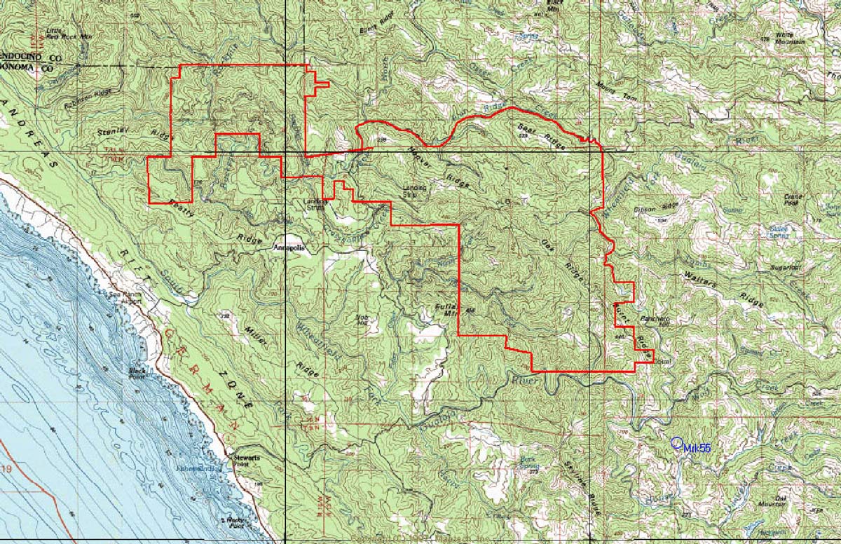
Preservation Ranch, in the heart of the Gualala River watershed
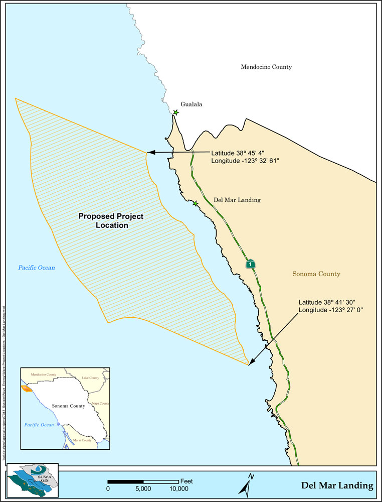
Del Mar Landing [Sonoma County Water Agency]
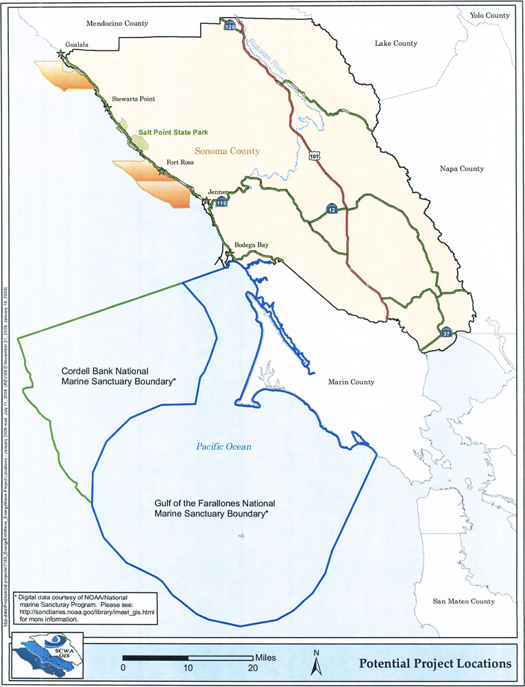
Wave energy project off the Gualala coast?
Del Mar Landing [Sonoma County Water Agency]