 Friends of Gualala River Protecting the Gualala River watershed and the species living within it
Gualala River estuary / lagoon at sunset, April 27, 2026. Photo courtesy of Efi Benjamin, River Bend Kayaks.
Read More »Gualala River Sunset

Gualala River estuary / lagoon at sunset, April 27, 2026. Photo courtesy of Efi Benjamin, River Bend Kayaks.
Read More »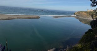
The River is at Equilibrium with the Ocean, March 27, 2026. Photo courtesy of Jeanne Jackson.
Read More »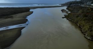
Drone video of Gualala River estuary and mouth on Nov. 17, 2025. River mouth is open after heavy rain. Drone video courtesy of Bonny Dunn.
Read More »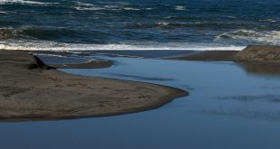
Thursday, November 13, 2025 at noon: Gualala River lagoon is full to the brim after heavy rain and before the mouth opens. Thursday, November 13, 2025 at noon: Gualala River mouth is still closed after heavy rain. The river mouth started to breach around at 5 pm Thursday, on a rising high tide, which equalizes tide and lagoon water levels …
Read More »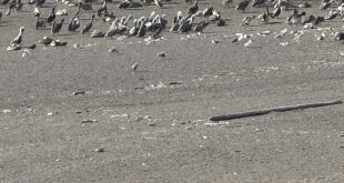
Gualala River barrier beach, September 12, 2025 (pelicans in the distance) Close-up of the pelicans Photos courtesy of Jeanne Jackson
Read More »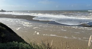
Mouth of the Gualala River after heavy rain – Feb. 14, 2025 Storm waves overtop the barrier beach of the Gualala River – Feb. 14, 2025 Mouth of the Gualala River after a quieter week – Feb. 21, 2025 Gualala River estuary turns ‘steelhead green’ – Feb. 21, 2025 Photos courtesy of Jeanne Jackson
Read More »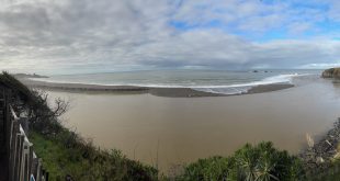
After days of steady rain Photos courtesy of Jeanne Jackson
Read More »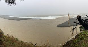
Gualala River mouth after atmospheric river pours down rain for 36 hours, Nov. 21, 2024, photo by Thomas Wolbarst, used with permission. Note: When the river mouth is closed by the sandbar, the lower part of the river is called a lagoon. When the mouth is open to the ocean, it is called an estuary.
Read More »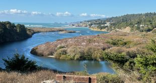
Gualala River lagoon after the rain, Nov. 15, 2024, photo by Jeanne Jackson, used with permission. Note: When the river mouth is closed by the sandbar, the lower part of the river is called a lagoon. When the mouth is open to the ocean, it is called an estuary.
Read More »
Video by David Lichtman, October, 2024, used with permission
Read More »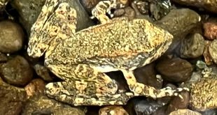
Yellow-legged Frog in the Gualala River, photo by Amy Ruegg “Down by the Gualala River near the Hot Spot, we enjoyed seeing a variety of small aquatic creatures like water beetles, tiny fish, and a foothill yellow-legged frog! It was just a small one in the water blending in perfectly with the rocks. No more than an inch or so …
Read More »
Gualala River Lagoon, June, 2024, photograph by Anthony Cuesta, reprinted with permission “When the sandbar stops much of the river water from entering the Pacific Ocean, the mouth of the river floods beautifully into its natural floodplain. Anthony Cuesta photographed the Gualala River from Gualala Point Regional Park, showing Mill Bend. You can see a portion of the Gualala River …
Read More »
June 9, 2024 by a Friend of the Gualala River We walked the Wheatfield Fork of the Gualala River under the second twin bridge off Annapolis Road. What a beautiful and peaceful walk! We couldn’t photograph any birds as they were mostly in the canopy and quickly catching insects. However, we saw and heard the following: Black-headed grosbeak, red-breasted sapsucker, …
Read More »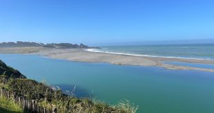
Mouth of the Gualala River on June 6, 2024; photo courtesy of Efi Benjamin, River Bend Kayaks
Read More »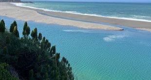
Mouth of the Gualala River on May 20, 2024; photo courtesy of Bob Rutemoeller
Read More »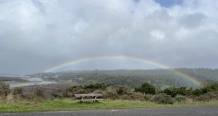
Rainbow over the Town of Gualala, with the Gualala River estuary, after severe wind storm; February 7, 2024 Rainbow over the Town of Gualala after severe wind storm; February 7, 2024 Photos courtesy of Jeanne Jackson
Read More »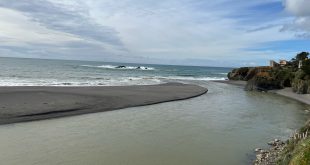
Gualala River mouth after more heavy rain, February 3, 2024 Gualala River estuary and barrier beach, February 3, 2024 Photos courtesy of Jeanne Jackson
Read More »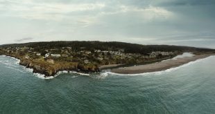
Taken on January 12, 2024 at the end of the king tide.Photo by Bonny Dunn, BonnyDunn.com reprinted with permission.
Read More »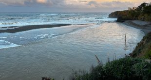
A beautiful photo of our favorite river, taken on the afternoon of January 3, 2024 by Chris Braley. Thanks to Chris Braley for this inspiring image.
Read More »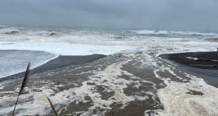
After the storm on December 27, 2023, the Gualala River was running high and fast. The Pacific Ocean was roiled up with huge breakers and the river was full from the rains. Here’s a video of the action. See if you can spot the River Otter swimming in the raging river! Here’s what it looked like on Thursday morning, December …
Read More »