 Friends of Gualala River Protecting the Gualala River watershed and the species living within it
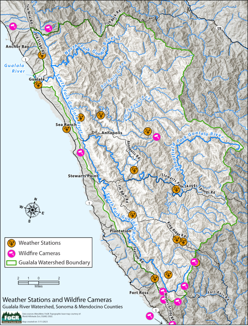
[Scroll down for map to appear]
Click on a weather station or wildfire camera to display information
Map created by: Digital Mapping Solutions
More information: Map of Real-time Weather Stations & Wildfire Cameras in the Gualala River Watershed
Sources:
Weather stations: MesoWest (U. of Utah), PG&E, Davis Weatherlink, Wunderground
Wildfire cameras: Alert California, a public safety organization based at UCSD working with firefighters to reduce wildfire risks and understand fire’s impacts on people and the environment. The wildfire cameras are intended to increase citizen wildfire spotting.
Note:
Some weather stations / wildfire cameras might be offline at any given time for a variety of reasons.