Home»News»Major Landslide on Wheatfield Fork, Gualala River, closes Stewarts Point-Skaggs Springs Road
Major Landslide on Wheatfield Fork, Gualala River, closes Stewarts Point-Skaggs Springs Road
Stewarts Point-Skaggs Springs Road, west of landslide near Soda Springs site (USGS map place-name). March 3, 2019.
February 26-27, 2019, flood triggered a major landslide on the Wheatfield Fork, Gualala River, above and below Stewarts Point-Skaggs Springs Road. The large landslide occurred on steep north-facing slopes near the Soda Springs site (USGS map place-name), near the east end of Fuller Mountain, approximately 2.5 air miles east of the Annapolis Road bridge.
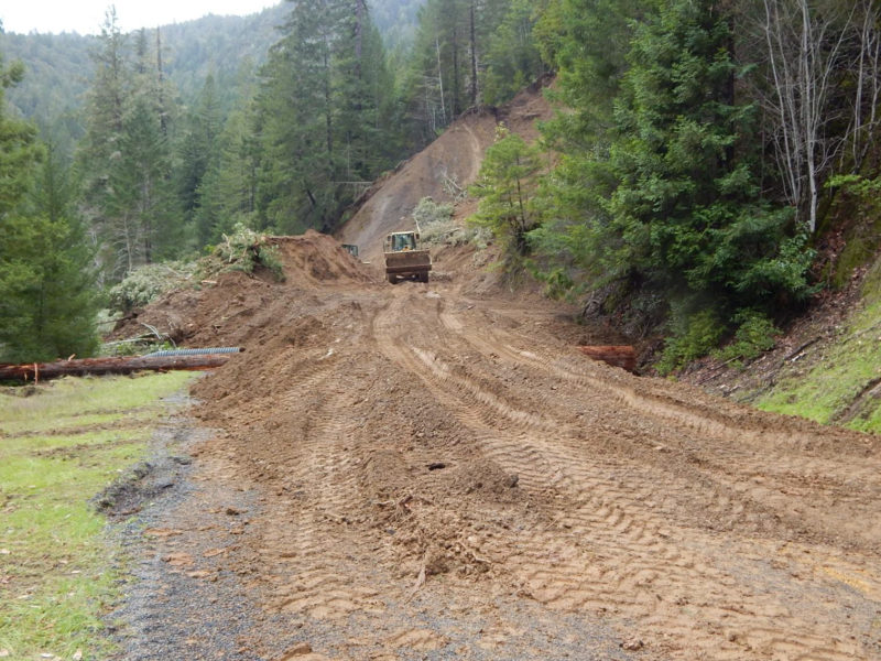
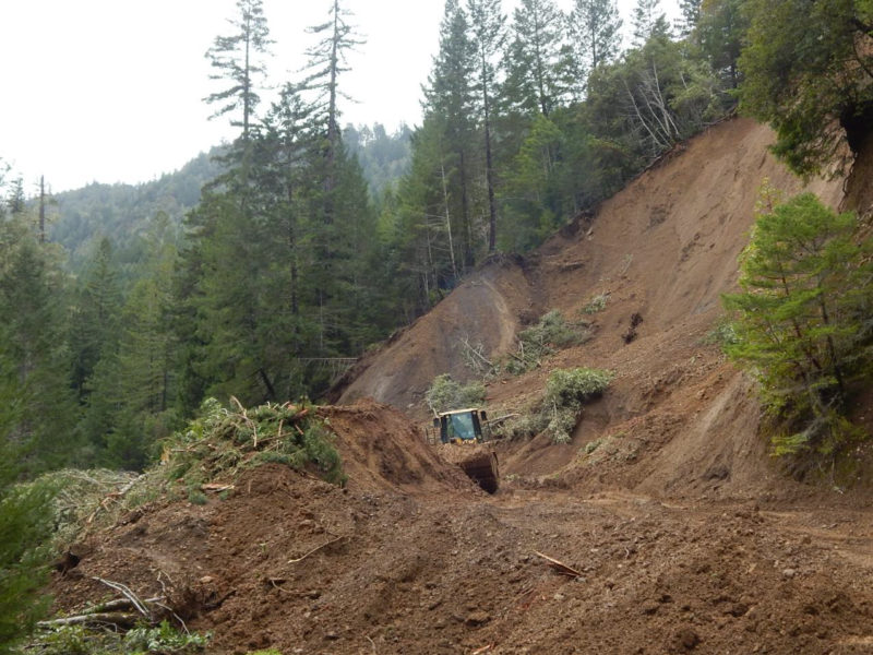
The landslide extends from about 300 feet or more above the river, to the south bank of the river. The width of the slide zone is probably well over 600 feet. The road is buried under about 8-15 feet of landslide debris, and is closed to traffic between Annapolis Road and Lake Sonoma, Healdsburg as of March 3.
Over 14 inches of rainfall were reported on Fuller Mountain during the February 26-27 storm. As of March 3, there was a surprising lack of a distinct turbidity plume (opaque bright tan-brown suspended clay and fine silt) downstream of the landslide, after two days of low rainfall. Rapid erosion during high flows appears to have removed much fine sediment at the foot of the unstable slope, concentrating a temporary resistant lag of rocky debris.
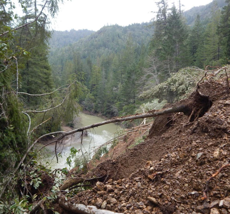
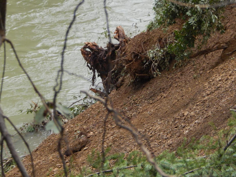
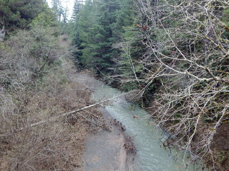
The unconsolidated saturated mass of subsoil, boulders, and cobbles reaches down to the river bank, where it has been eroded by high flows. Eroded sand bars and gravel bars, and large deposits of uprooted alders, logs, and woody debris, are evident all along the Wheatfield Fork.
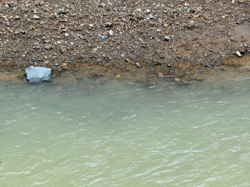
Downstream of the landslide, submerged cobbles along the river bank can be seen at depths about 6 inches to one foot below the water surface on March 3. The water’s hue is olive gray-green, in contrast with the highly turbid, nearly opaque bright tan brown (“café latte” appearance) during the storm. Further erosion and turbidity increases may occur with subsequent rainfall. The landslide is likely to take many years to partially revegetate, recover and stabilize, after the road is reopened. Relatively full recovery may take decades.
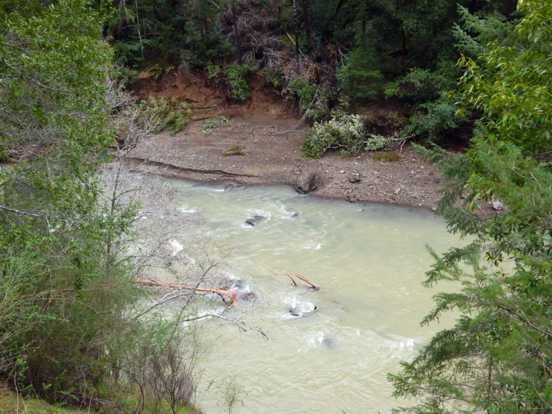
Landslide extending below Stewarts Point-Skaggs Springs Road to the Gualala River Wheatfield Fork. Unconsolidated shale and subsoil slope to the river’s south bank at the downstream end of the landslide, west of Soda Springs site (USGS map place-name). March 3, 2019.
Landslide extending below Stewarts Point-Skaggs Springs Road to the Gualala River Wheatfield Fork. Unconsolidated shale and subsoil slope to the river’s south bank at the downstream end of the landslide, west of Soda Springs site (USGS map place-name). March 3, 2019.
Landslide sediment removal at Stewarts Point-Skaggs Springs Road west of landslide near Soda Springs site (USGS map place-name). March 3, 2019.
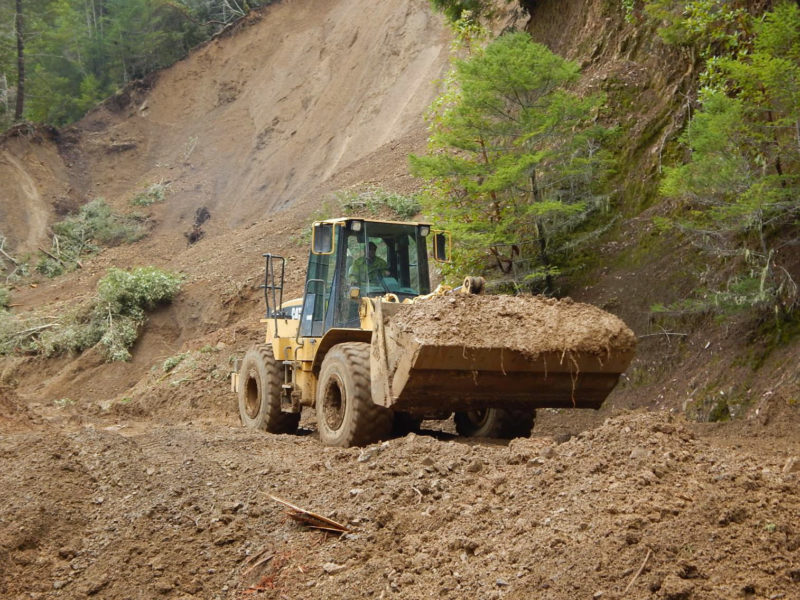
Landslide at Stewarts Point-Skaggs Springs Road west of Soda Springs site (USGS map place-name). Partial removal of landslide at and above the buried road surface. March 3, 2019.
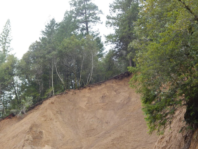
Landslide at Stewarts Point-Skaggs Springs Road west of Soda Springs site (USGS map place-name). Scarp at top of landslide, about 300 ft above the riverbed. March 3, 2019.
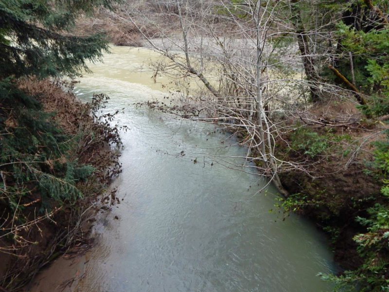
River turbidity immediately downstream of landslide. Olive hue, depth of visibility over 6 inches below water surface. No distinct turbidity plume is evident. March 3, 2019.
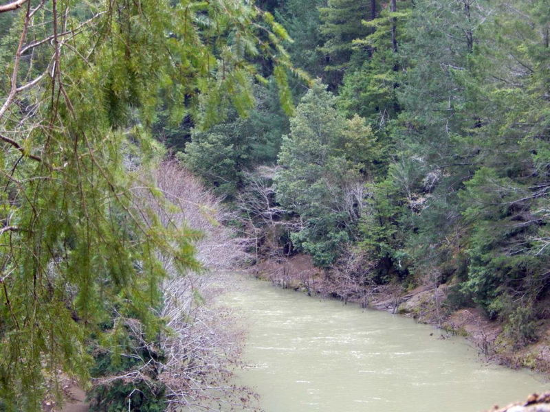
River turbidity upstream of landslide; similar to downstream. March 3, 2019.
River turbidity downstream of landslide; olive gray-green hue; visibility to depth of at least 6 inches. Note visible cobbles shallowly submerged below the bank. March 3, 2019.
River turbidity downstream of landslide; olive gray-green hue; visibility to depth of at least 6 inches. Note visible cobbles shallowly submerged below the bank. March 3, 2019.
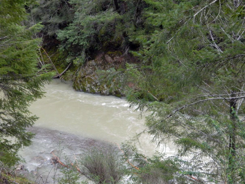
The confluence of Haupt Creek (a historic coho spawning tributary of the Wheatfield Fork) and the Wheatfield Fork show a marked contrast in turbidity on March 3. Haupt Creek turbidity is low, with aqua-green hue and transparency of water to over one foot below the water surface. Haupt Creek above mouth. March 3, 2019.
The confluence of Haupt Creek (a historic coho spawning tributary of the Wheatfield Fork) and the Wheatfield Fork show a marked contrast in turbidity on March 3. Haupt Creek turbidity is low, with aqua-green hue and transparency of water to over one foot below the water surface. Haupt Creek at confluence with Wheatfield Fork, March 3, 2019.
 Friends of Gualala River Protecting the Gualala River watershed and the species living within it