More river flood action photos. In this set: the Wheatfield Fork. Includes floodplain submergence (deeper than mid-February) at Twin Bridges, showing the Dogwood THP Haul Road covered in mud. Also shows Annapolis Road Bridge at Clark’s Crossing with log and wood debris on top, for the first time in decades!
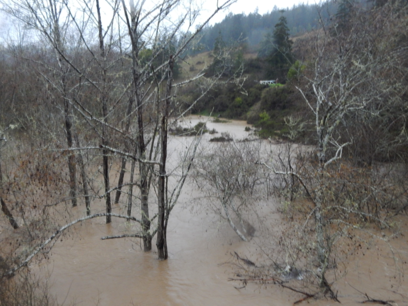
Feb 27, 2019: Wheatfield Fork Gualala River, Valley Crossing, Annapolis Road; view to west, north side. The floodplain riparian woodland here is deeply submerged, about 5 feet or more.
Feb 27, 2019: Wheatfield Fork Gualala River, Valley Crossing, Annapolis Road; view to west, south side. The floodplain riparian woodland here is deeply submerged, about 5 feet or more. The outer edge of the alder riparian woodland is jammed with logs.
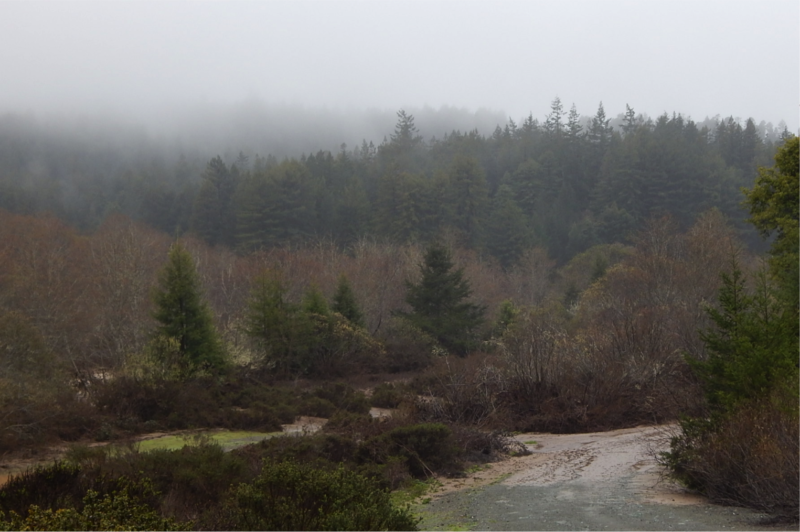
Feb 27, 2019: Wheatfield Fork Gualala River, Valley Crossing, Annapolis Road. Fine sediment (light brown mud) is deposited over the inner floodplain, including the Haul Road between Gualala and Annapolis Road that runs through the Dogwood THP area.
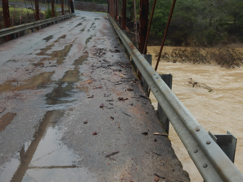
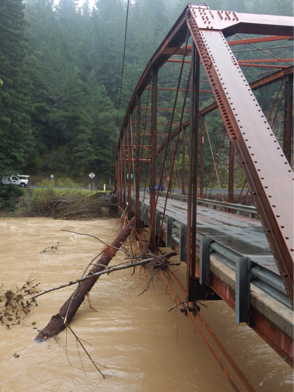
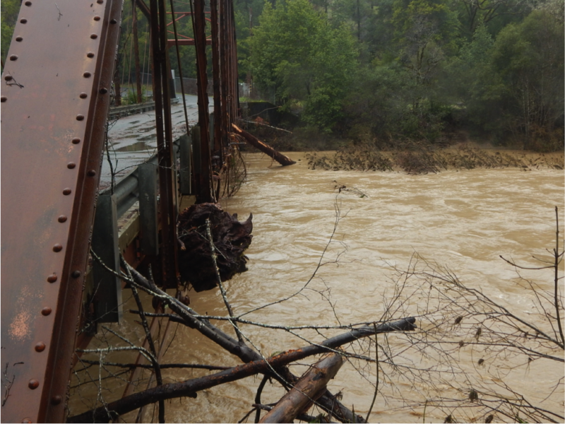
Feb 27, 2019: Wheatfield Fork Gualala River. Annapolis Road Bridge at Clark’s Crossing (Stewarts Point-Skaggs Springs Rd.). Flood debris overtopped the bridge platform; overnight peak flood levels.
Feb 27 2019: Wheatfield Fork Gualala River. Annapolis Road Bridge at Clark’s Crossing (Stewarts Point-Skaggs Springs Rd.). Redwood log and woody debris is jammed into the top of the bridge, upstream side.
Feb 27 2019: Wheatfield Fork Gualala River. Annapolis Road Bridge at Clark’s Crossing (Stewarts Point-Skaggs Springs Rd.).
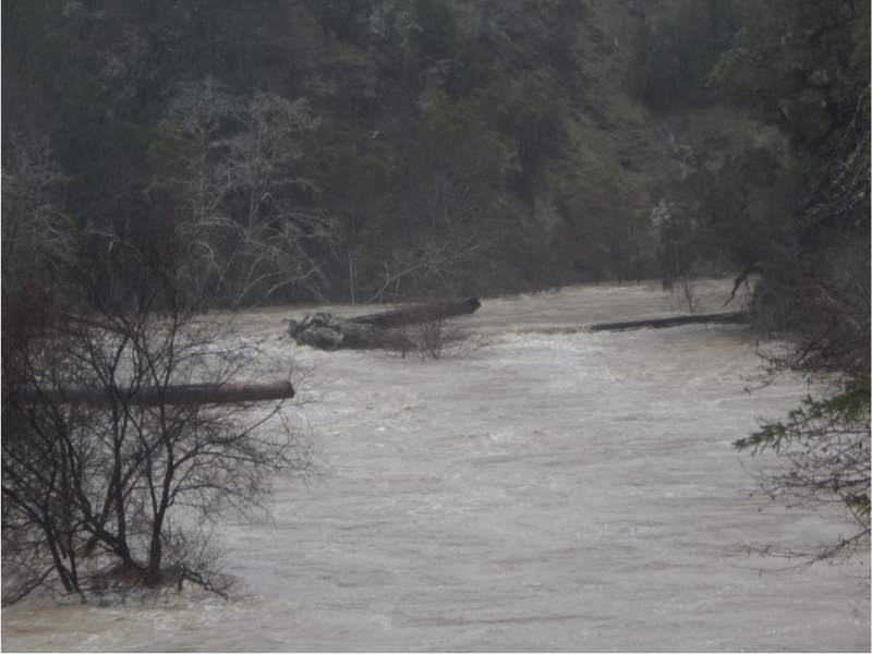
Feb 26, 2019: Wheatfield Fork Gualala River. Upstream of Annapolis Road Bridge at Clark’s Crossing (Stewarts Point-Skaggs Springs Rd.). Compare with next photo →
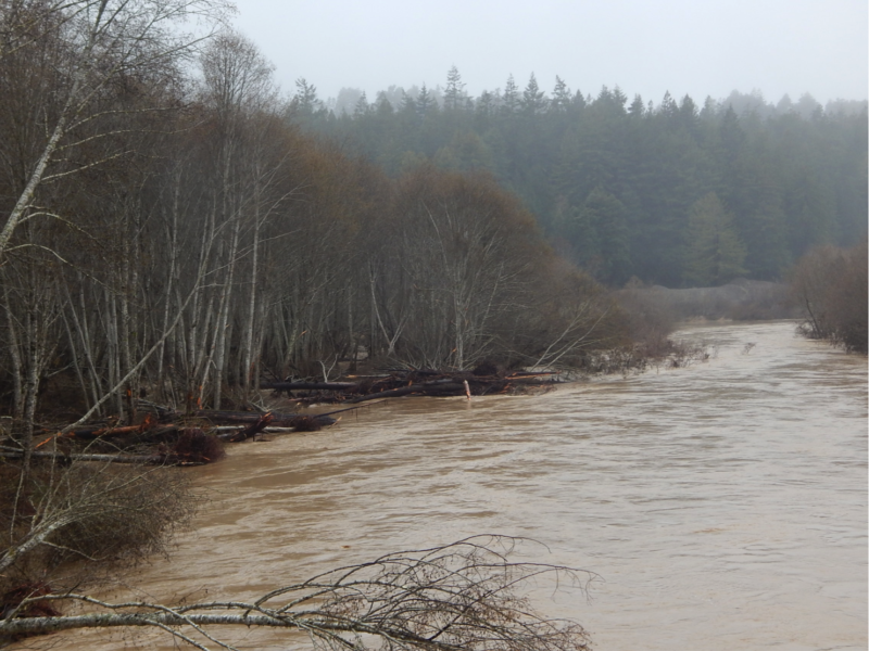
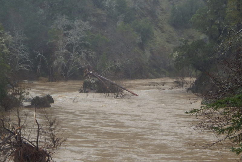
Feb 27, 2019: Wheatfield Fork Gualala River. Upstream of Annapolis Road Bridge at Clark’s Crossing (Stewarts Point-Skaggs Springs Rd.). Water level about 5-6 feet lower than previous photo. Large old logs pinned to rock outcrops for decades were flooded away.
 Friends of Gualala River Protecting the Gualala River watershed and the species living within it