 Friends of Gualala River Protecting the Gualala River watershed and the species living within it
Updated August 12, 2015
Friends of Gualala River hired a geographic information system (GIS) specialist to take the multiple timber harvest plan (THP) maps submitted and make new composite maps that are readable in context of the landscape and past logging.
The full extent of the footprint of the logging plans in the lower Gualala River floodplain redwood forest and adjacent slopes are fully revealed in these new maps. The GIS specialist on the project is Digital Mapping Solutions.
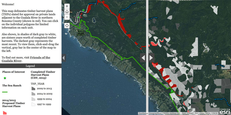
Interactive Map:
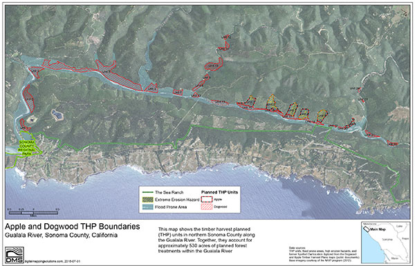
Apple and Dogwood THP Boundaries
Gualala River, Sonoma County, California
Click on the map above for an interactive version,
showing an overlay of past logging activity, and notable features
(The Sea Ranch, the Hot Spot, Gualala Point Regional Park, etc.)
Apple and Dogwood THP Boundaries
Gualala River, Sonoma County, California
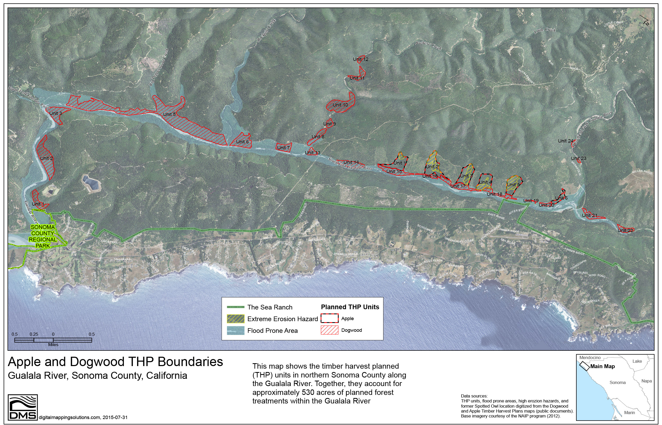
This map shows the timber harvest planned (THP) units in northern Sonoma County along the Gualala River. Together, they account for approximately 530 acres of planned forest treatments within the Gualala River.
Click on the map for a larger image, or download an even larger version in pdf format: Apple and Dogwood THP Boundaries (6.0 MB pdf)
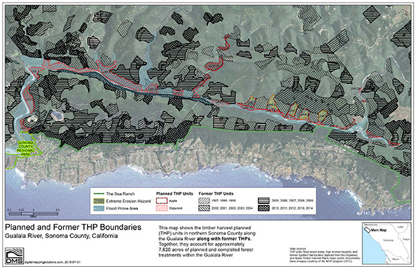
Planned and Former THP Boundaries
Gualala River, Sonoma County, California
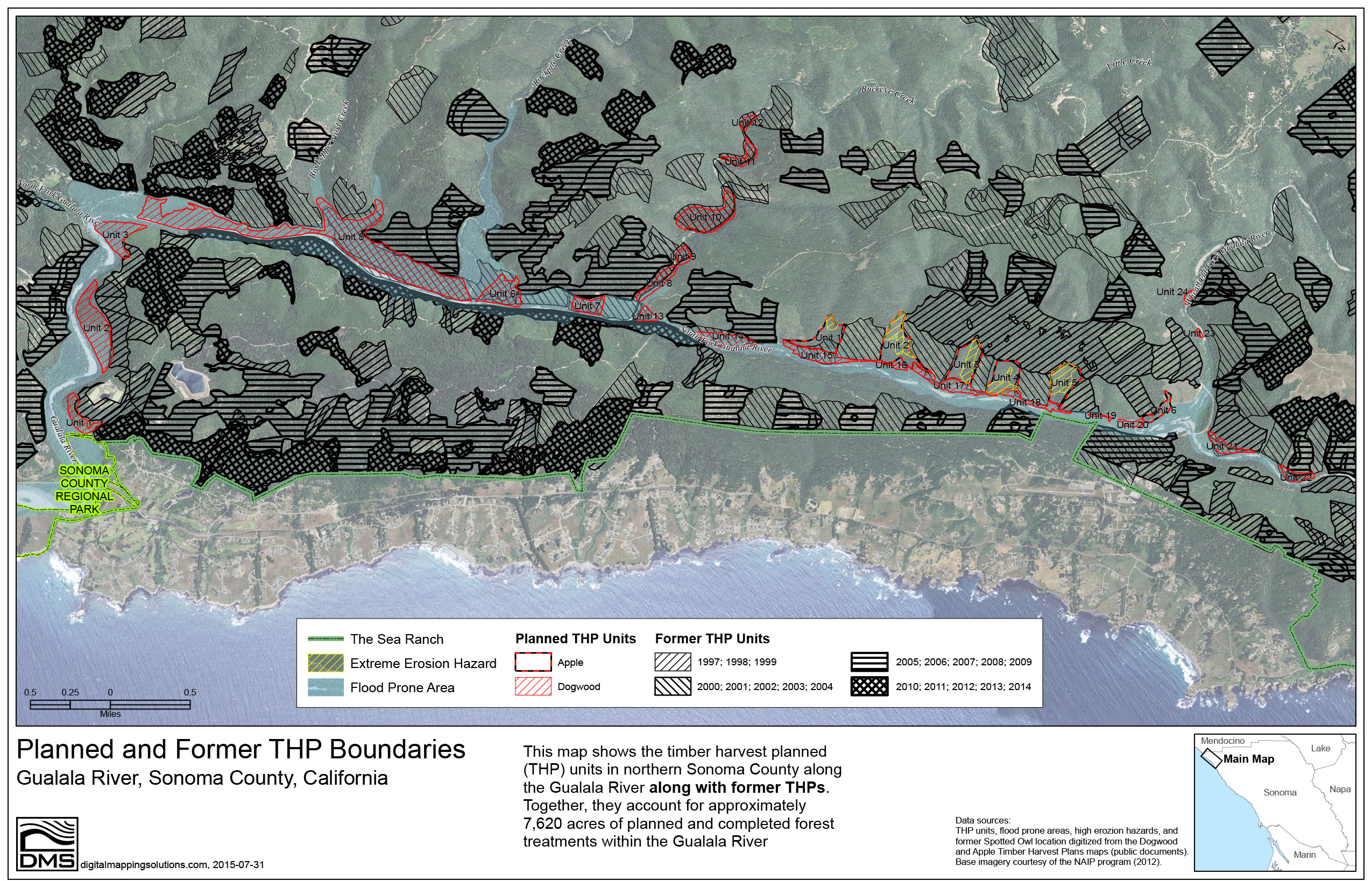
This map shows the timber harvest planned (THP) units in northern Sonoma County along the Gualala River along with former THPs. Together, they account for approximately 7,620 acres of planned and completed forest treatments within the Gualala River watershed.
Click on the map for a larger image, or download an even larger version in pdf format: Planned and Former THP Boundaries (6.6 MB pdf)