Upper reaches have water – and fish
September, 2008
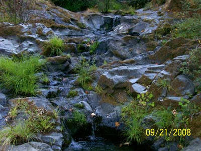
Middle section of Grasshopper Creek Falls –
10″ steelhead are in lower pool.
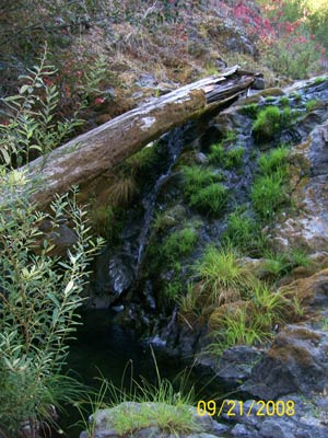
Lower Grasshopper Creek Falls –
6 and 10″ steelhead are in bottom pool.
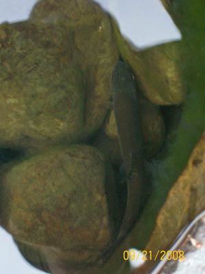
10″ steelhead above Grasshopper Creek Falls,
hiding in large bedrock pothole. Yes, above the falls.
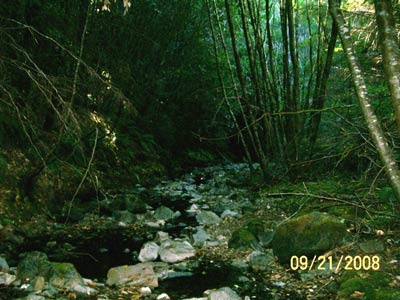
Six years ago this section of Grasshopper Creek was filled with clay and fines. No gravel was visible. Now it is boulder, cobble and gravel. Steelhead fry are abundant. Yes, above the falls.
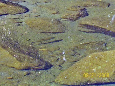
9″ Steelhead in Buckeye Creek.
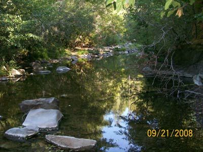
In Buckeye Creek, water is flowing continuously and steelhead are abundant – unlike the de-watered lower reaches of this summer’s Wheatfield and South Forks.
There appeared to be several hundred steelhead in the quarter mile stretch of Buckeye below the entrance of Grasshopper Creek. Two years ago this section was filled with quarter-inch gravel. Now it’s more a mixture of boulder, cobble and gravel. Pools are much deeper now. There were at least half a dozen 8-10″ steelhead in this section. Smaller sizes of steelhead are abundant, as well as roach, stickleback and other (including a large crayfish).
Buckeye Creek, Fuller Creek, and upper Wheatfield — ALL the tributaries, actually, are canyon creeks incised in bedrock or ancient landslides. They aren’t perched on deep alluvium and groundwater. Baseflows go right in to low flows. Only the mainstems of the lower Wheatfield and South Forks on deep alluvium feel the drawdown of groundwater and wells.
The problem is that larger pools are rare on the tributaries. Large fish like these have little habitat except in large pools of the lower mainstem.
The tributaries and upper Wheatfield are already rising (submerged white sun-bleached algae), but the lower reach pools are now gone…. beds of mummified, stinking tadpole carcasses.
See also:
Gualala River: Going, going . . . gone Channel pools in the Gualala River continued to diminish unevenly in late summer. The areas of strongest pool drawdown and dewatering are in the vicinity of water-demanding land uses (vineyards, gravel wells associated with mining and timber harvest, and commercial water trucking) adjacent to deep gravels.
Where has the water gone? In the summer of 2008, the Wheatfield Fork of the Gualala River dried up to small, isolated, shallow pools below the Annapolis Road bridge while the river’s pools remained normal and stable upstream.
 Water hits the road in Annapolis
Water trucks become a common sight in Annapolis during summer months as wells and reservoirs run dry in this water scarce area.
Summertime Dewatering: Slow but Sure Death to the River! As summer progressed, more and more main-stem, downstream reaches have developed intermittent surface flows characterized by a series of slowly drying pools, or worse – up to hundreds of linear feet of stream without any surface flow at all!
 Friends of Gualala River Protecting the Gualala River watershed and the species living within it
