by Peter Baye,
Friends of Gualala River
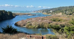
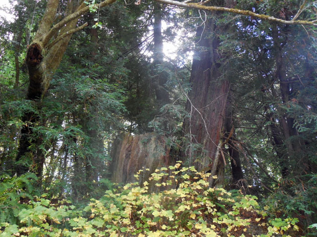
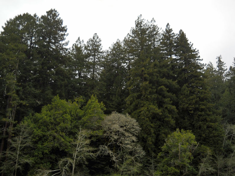
The lower Gualala River has a wide meandering floodplain rich in wetlands, mature productive riparian redwood forests and highly diverse riparian habitats supporting many special-status plant, fish, and wildlife species. “Flood prone” redwood forests are supposed to be protected by avoidance of logging disturbances under special salmonid protection rules under the Forest Practices Act.
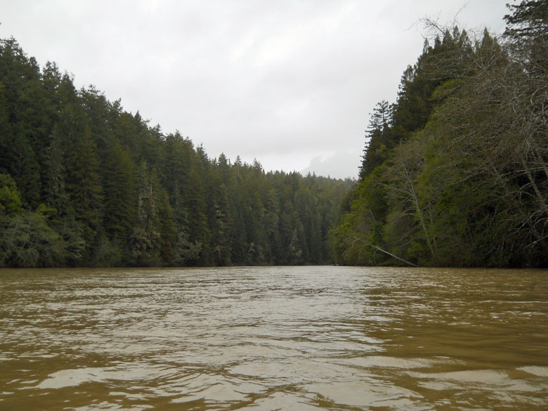
Despite the special protected status of floodplain redwood forests, Gualala Redwood Timber LLC (GRT; formerly Gualala Redwoods Inc., purchased in 2015 by Redwood Empire, owned by the Roger Burch family) proposes in the new “Dogwood” timber harvest plan (THP) to log 320 acres along 5 miles of the lower Gualala River’s redwood floodplain forest, taking 90 to 100 year old redwoods almost to the edge of Gualala Point Regional Park, and adjacent to the river’s sensitive estuary. Gualala Point Regional Park is one of the only public recreation areas in the entire watershed. The “Dogwood” THP, however, concluded with that the logging would have no effect on recreation, but with no analysis of the potential impacts of next-door logging of “Unit 1” on the regional park, and offered no mitigation.
To add to the impacts of logging hundreds of acres of floodplain redwood forest, the “Dogwood” and adjacent “Apple” THPs also propose to guzzle an incredible 25,000 gallons per day of Gualala River water during the dry season (April to November) over the 5 year timber harvest permit period. Not only does this conflict with Forest Protection Act “Anadromous Salmonid Protection” rules requiring avoidance of water drafting in forested “flood prone areas”, but the THP’s incredible determination that it would have “no effect” on flows was based on an outdated 2010 hydrology report (prepared before the current historic drought) with no consideration of the drought impacts on Gualala River’s deficient minimum summer flows, and Gualala’s municipal water supply. In addition, no analysis of the THP’s major water diversion during drought on listed salmonids was prepared. Yet the responsible agencies and affected downstream public water users have raised no red flags about the massive diversion of river water during the drought.
Aggressive logging plans previously proposed by Gualala Redwoods Inc. (GRI) have either been denied permits, or have been forced to withdraw them due to strenuous objections by resource agencies over impacts to endangered fish and wildlife species of the river and its wide riparian zone. One of the last failed efforts to log the floodplain was the GRI “Iris” timber harvest plan of 2004.
The “Dogwood” and “Apple” THPs
GRT, unfortunately, has apparently taken an even more aggressive and ambitious attitude towards floodplain logging since it took over its predecessor GRI early in 2015. Plans to log the floodplain redwood forest resumed activity in fall 2014 when flagging appeared in the floodplain – a harbinger of timber harvest plan surveys and mapping. GRI forestry planning is still under direction of the former forester of Pacific Lumber Company [PALCO], the infamous “liquidation logging” timberland owner of the old growth Headwaters Forest after acquisition.
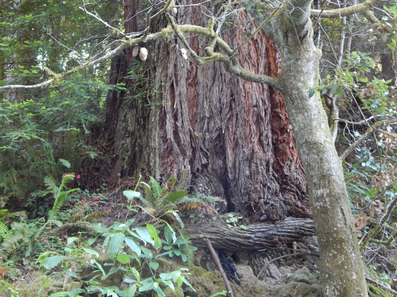
Early in 2015, GRI quickly submitted previously prepared twin timber harvest plans (THPs): one covering 320 acres and over five miles of floodplain forest (“Dogwood” THP, 1-15-042 SON), and another covering 121 acres the steep hillslopes above the floodplain (“Apple” THP, 1-15-033 SON), including nearly 90 acres of clear-cuts above the river. Together, these contiguous THPs comprise a larger cumulative logging impact on the lower Gualala River and its floodplain than any in modern memory: “Dogwood” THP proposes to log floodplain redwood forest with maturing redwoods 90 to 100 years old, including extensive areas of understory seasonal and perennial wetlands.
Environmental Stakes and Impacts of Floodplain Forest logging on the Gualala River
GRT has conducted no surveys for endangered, threatened and other special-status fish and wildlife species in the floodplains, adjacent upland forests, and the lower Gualala River, including the estuary. GRI has simply told Fish and Wildlife agencies that it doesn’t believe marbled murrelets and western pond turtles or California red-legged frogs occur anywhere near the lower Gualala River, and used this self-serving belief to justify omitting species-focused surveys in advance of permits to log the floodplain. This premise is simply false: local citizen scientists have confirmed that California red-legged frogs occur at least as close as Salal Creek in Sea Ranch, and marbled murrelets have been sighted this summer on the South Fork of the Gualala River. Western pond turtles occur throughout the River’s forks and tributaries where suitable channel pools exist. California Department of Fish and Game have asked CAL FIRE for needed survey data to ensure protection of special-status fish and wildlife.
Similarly, GRT conducted absolutely no surveys for rare plants or wetlands in the Dogwood or Apple THPs. GRT claims that an outdated 1998 rare plant assessment by Clare Golec, last updated in 2001, suffices for up-front analysis of impacts to rare plants — along with GRI’s assurances to protect rare plants if they are detected after GRT receives permits! This ensures that no meaningful public or expert botanical or ecological comments would be possible prior to permit issuance. Not even plant survey methodology or criteria for qualifications for botanists (or timber operators) are proposed in the THPs. And no location-specific restrictions on the type, location, or amounts of herbicides are proposed to protect wetlands or rare plant populations or seed banks of the floodplain.
This kind of impermissibly vague and deferred “mitigation” for sensitive plant species, communities, and wetlands is contrary to both CEQA (THPs are legally “equivalent” of CEQA, or are supposed to be) and Forest Practice Rules (FPRs), particularly those FPRs aimed specifically at protection of “flood prone” timberland areas. Yet the THP preparers make the ludicrous claim that impacts to sensitive plant species in 320 acres of floodplain would be less than significant because of future surveys and minimal standard set-backs for watercourses.
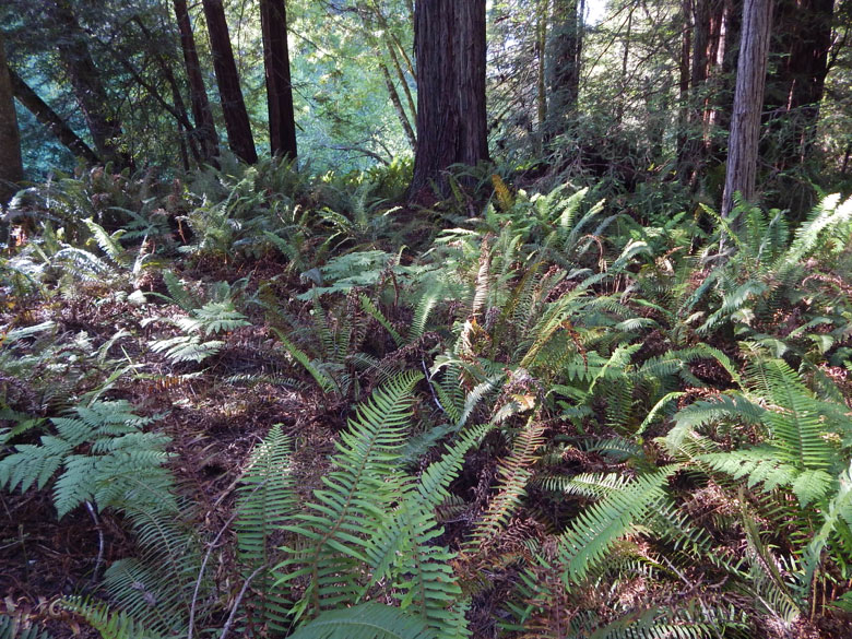
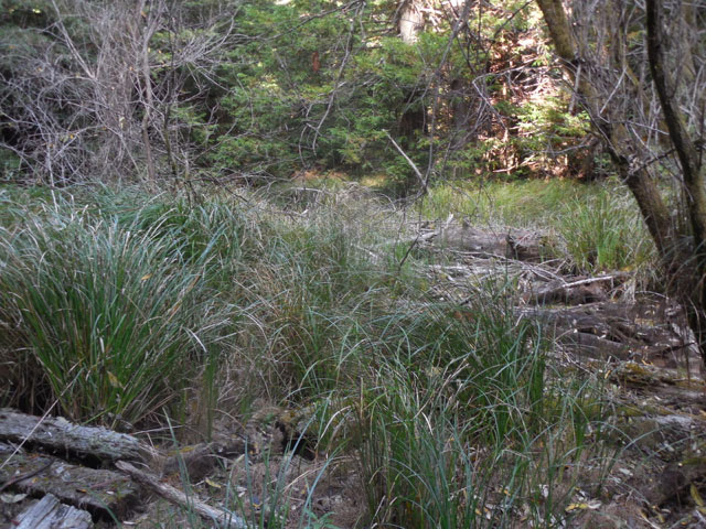
The ecological and plant conservation stakes for the floodplain THP are extremely high. The floodplain of the lower Gualala River supports extensive and variable wetlands variously dominated by slough sedge, panicled bulrush, chain fern, and horsetails. Wetlands and moist riparian zones support populations of the rare California bellflower, many species of uncommon to rare orchids, coast lily, leopard lily, Pacific yew, and other regionally rare plants. Neither wetlands nor rare plants have been surveyed, so there are no specific plans to protect them against disturbances of logging, skid roads, or herbicide use.
When the redwood forest floodplain is inundated, dense thickets of huckleberry, California blackberry, and sedge marshes provide critically important roughness (friction and surface area) to trap and stabilize fine sediment, removing it from the river and returning clearer water – a highly significant ecological and geomorphic function of floodplains that Board of Forestry regulations are supposed to protect along with special-status plants. But the sediment-trapping and water quality functions of the floodplain are neither analyzed nor protected by the Dogwood THP. No wetland delineations, no vegetation maps, and no plant surveys were used to plan the timber harvest, layout of skid roads, or site-specific mitigations. This would not even be accepted as a complete application for a CEQA-regulated project.
Endangered and threatened fish and wildlife species fare no better under the THPs. No current surveys were prepared or submitted – just conclusions that species like marbled murrelets and California red-legged frogs were not present (despite existence of suitable habitat and nearby recent past observations), or that they would not be significantly impacted if they were present because forest protection rules are so effective at conserving them.
Forest Protection Act and environmental rules that should apply
Forest Protection Rules specifically protect “flood prone” forests like those of the Dogwood THP, and even GRI conceded “unique potential impacts” of its proposed floodplain logging (p. 109). But in a perverse inversion of CEQA mitigation requiring minimization of direct, indirect, and cumulative impacts, GRI rejected alternatives to reduce the footprint and intensity of floodplain logging because it believes would be better to “spread out” impacts, and because it is not willing to cut less of the large, old floodplain redwood forest (pp. 107-109)!
A consortium of non-profit conservation forestry, land trust, and open space district organizations offered to purchase GRI after it was offered for sale in 2014, but the offer was declined. Sonoma County Regional Parks would likely have been expanded to Twin Bridges if that purchase had occurred. Instead the “Dogwood” THP contemptuously attacks almost everything that would have become a riparian park like that of Big River, and proposes logging in “Unit 1” almost up to the edge of the Park’s campgrounds.
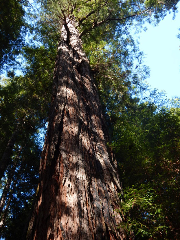
The lower Gualala River is not a tree farm. It is the primary gateway of the Gualala River providing public access, wildlife conservation, clean and abundant water, and tranquil scenic views supporting a robust eco-tourism foundation for Gualala businesses. Generations would have to pass before the logged forest could recover to the mature state (80-100 year old redwoods) it is now. That would be unlikely under GRI’s “tree farming” philosophy of cutting beyond the maximum allowed by law: “Dogwood” THP requires a request for CAL FIRE making exceptions to timber rules protecting “flood prone” redwood forests to cut even more than is allowed for private gain at the expense of public interest in public water, public parks, public wildlife. It is not a good neighbor policy.
CAL FIRE is seldom conscientious or responsive to public comments, but it has some obligations towards California Department of Fish and Wildlife (CDFW), North Coast Regional Water Quality Control Board (RWQCB Region 1), and National Marine Fisheries Service (NOAA Fisheries) for environmental protection. Because THPs are obscure environmental documents compared with EIRs, and lack public notice, GRI, CAL FIRE, and these agencies usually hear little from the public when THPs are issued. Friends of the Gualala River are encouraged to directly contact GRI, CAL FIRE, and responsible state and federal agencies, as well as the elected officials who oversee their budgets.
What you can do: Promptly contact government agencies and elected officials with oversight and responsibility for analyzing and permitting this THP, and put your concerns on record. A contact list is provided below, along with recommended priorities for comments that carry weight under the Forest Practices Act and other environmental laws.
Contact information for THP comments:
CAL FIRE: santarosapubliccomment@fire.ca.gov
GRI’s new owners, Redwood Empire, care of Sean Burch, Gen Mgr: sburch@redwoodemp.com
GRI, care of Henry Alden, Senior Vice President: halden@deltapac.com
Regional Water Quality Control Board, Region 1, Santa Rosa; North Coast unit timber harvest review:
Fred Blatt: Fred.Blatt@waterboards.ca.gov, head of division overseeing timber harvests for the region
James Burke: James.Burke@waterboards.ca.gov, head of section overseeing the southern unit of the North Coast subregion
Contact State Assembly and Senate members, requesting they ask for updates on the status of the Dogwood THP and ask how CAL FIRE will address public interest concerns:
State Assembly – 2nd District, Jim Wood: https://lcmspubcontact.lc.ca.gov/PublicLCMS/ContactPopup.php?district=AD02
State Senate – 2nd District, Mike McQuire: http://sd02.senate.ca.gov/contact/email
What you can ask for if you agree with FoGR’s position:
|
Dogwood THP, in a nutshell:
- 320 acres of timber harvest in mature “flood prone” (frequent floodplain) second-growth redwood forest with mature structure over a 5 year period
- Logs “Unit 1” close to the edge of Gualala Point Regional Park
- No surveys for wetlands, ever
- No current surveys for special-status plants
- No current surveys for special-status wildlife it presumes to be absent despite known past occurrence and current suitable habitat
- No site-specific protections other than minimum standard set-backs for watercourses
- 25,000 gallons per day river water drafting April-November over 5 years including drought
- No alternatives analyzed to reduce extent, intensity, or pace of timber harvest
- Logs nearly all of potential future public access in riparian parkland for generations
THP Documents:
Downloads of multiple pdf documents comprising the THPs (caution: No table of contents or organization like a CEQA document) are available through the CAL FIRE website at:
1-15-042 SON “Dogwood”
ftp://thp.fire.ca.gov/THPLibrary/North_Coast_Region/THPs/THPs2015/1-15-042SON/
1-15-033 SON “Apple”
ftp://thp.fire.ca.gov/THPLibrary/North_Coast_Region/THPs/THPs2015/1-15-033SON/
 Friends of Gualala River Protecting the Gualala River watershed and the species living within it
