The Gualala River enters the Pacific Ocean approximately 110 miles north of San Francisco, marking the border of Sonoma and Mendocino counties. Just past the mouth of the river lies the town of Gualala, a three-hour drive from San Francisco over narrow, twisting roads and stunning ocean and mountain views. Tourism and logging are the primary local industries.
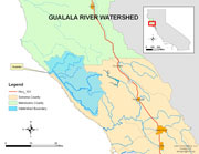
Gualala River watershed
[click to enlarge]
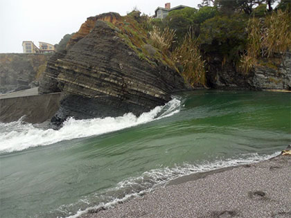
Gualala River Lagoon Breach
Saturday, April 6, 2013
Annotated photos by Peter Baye, ![]() 5 MB pdf.
5 MB pdf.
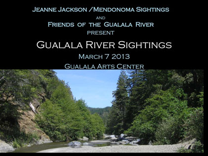
Gualala River Sightings
View the “Best of” the photographs presented at the 2013 Gualala River Sightings on March 7 at the Gualala Arts Center by Jeanne Jackson/Mendonoma Sightings & Friends of the Gualala River.
| October, 2007 Aerial Photo Tour of the Gualala River over 1,100 aerial photos, plus a Google Earth interface. |
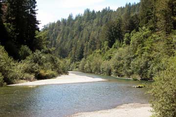
Wild & Scenic Gualala River
winding through coastal redwood forest [2003]
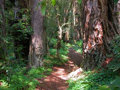
Upstream from Gualala Point Regional Park [2007]
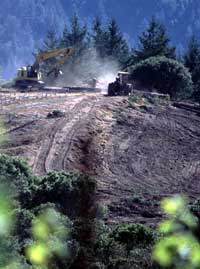 Forestland-to-vineyard conversion Annapolis, northwest Sonoma County |
New vineyards are spreading rapidly, replacing oak woodlands, grasslands, mixed evergreen forest, and even redwood forests of Sonoma and Mendocino County.Friends of the Gualala River successfully challenged the Dept. of Forestry’s false conclusion that conversions of forested watersheds to irrigated, intensive agriculture do not have any significant cumulative impacts on local streams. |
| Little Creek (photo at right), a fish-bearing stream in the Gualala River watershed, was threatened when investors proposed to convert three parcels of forestland near the creek to vineyards.Friends of the Gualala River mounted a vigorous scientific and legal defense of the little creek, and the Dept. of Forestry’s approvals of the proposals were overturned by the court. | 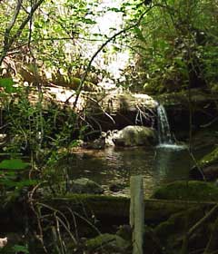 Little Creek, tributary to Buckeye Creek, Gualala River watershed |
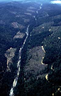 Gualala River, north-to-south aerial, June 1999 |
The South Fork of the Gualala River follows the San Andreas fault for 25 miles. The aerial photo at left shows the extensive checkerboard pattern of clearcut logging looking north to south down the length of the South Fork.Driving along the coast on Highway 1, the clearcuts are not visible; the severe impacts to the watershed ofunsustainable logging are hidden behind the first ridge of the Coastal Range of mountains. |
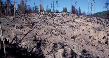
“Powerline” clearcut
after napalm-fueled burn
| In 2000, the largest remaining old growth coastal redwood forest in Sonoma County, on Haupt Creek in the Gualala River watershed, was slated to begin falling to chainsaws.After extensive efforts by Friends of the Gualala River and other environmental groups, the logging plan was rejected by the California Department of Forestry and Board of Forestry. |
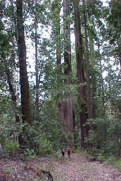 Old growth forest on Haupt Creek, Gualala River watershed photo credit: Dave Hope, NCRWQCB |
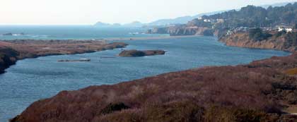
Gualala River estuary, full after the rains begin
and before the barrier beach is breached. [Oct 2004]
In 2001, a company funded by Saudi, Japanese and Norwegian interests proposed to trench and lay pipe up the Gualala River estuary, pump fresh water into giant polyfiber bags floating offshore, haul the bags south and sell the water.
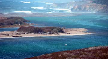
Gualala River lagoon & barrier beach. [Oct 2005]
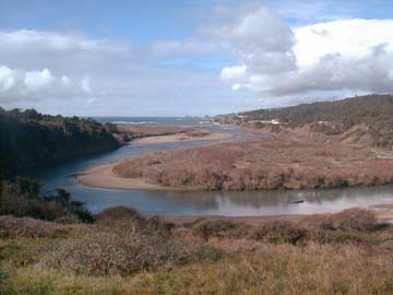
Gualala River estuary, January 2002
[click to enlarge]
| For more photos of the Gualala River watershed, see: Flyover of the Gualala River.For photos of the Gualala coastline, visit the California Coastal Records Project. |
 Friends of Gualala River Protecting the Gualala River watershed and the species living within it