| A version of this article was published in the Independent Coast Observer on September 2, 2005. |
By Julie Verran
Courtesy Independent Coast Observer, Gualala, CA
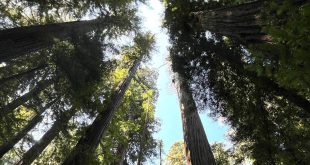
Working timberlands producing redwood and Douglas fir are part of the coastal community here.
On Tuesday, members of the Gualala River Watershed Council took members of the Gualala Municipal Advisory Council on a forest tour near Gualala and Annapolis, hosted by Henry Alden of Gualala Redwoods Inc. and Russ Shively of Mendocino Redwood Company.
In 2000, the GMAC advised Mendocino County to oppose a GRI Timber Harvest Plan in the bottom lands along the Little North Fork of the Gualala River. A major water source for the North Gualala Water Company is near the LNF at Elk Prairie.
The LNF watershed extends down from the top of the ridge that forms the backdrop for Gualala, and its headwaters are near the Refuse Transfer Station below Fish Rock Road.
The timber plan in 2000 was called “Cassidy.” It was denied by the California Department of Forestry and Fire Protection, and the denial was upheld by the Board of Forestry on appeal.
Last year, GRI filed an almost identical plan called “Lily,” which the GMAC is keeping an eye on. The council will discuss “Lily” and Tuesday’s forest tour at its meeting Thursday, Sept. 1, at the Gualala Community Center. The meeting starts at 6:30 with other matters.
Many of the members are new since the 2000 tour of the “Cassidy” plan, which drew 60 people, so this tour was designed to give GMAC members an idea of local timberlands.
Before the tour, volunteer Kathleen Morgan of GRWC gave a presentation at Gualala Arts Center showing maps, photos and charts of the 300-square mile watershed with an emphasis on stream restoration.
A geologic map showed the San Andreas Fault Zone just over the ridge from Gualala and Sea Ranch. The South Fork and the Little North Fork follow the fault for many miles in a nearly straight line with a very shallow gradient. Inland is a steep, complex landscape traversed by the Tombs Creek Fault.
The soils are highly erodible. One fourth of the land area is underlain by large, dormant landslides, and 10 percent shows active landslides.
“How much is man-caused?” asked GMAC Member Jeff Watts. “It’s all natural,” said Morgan. Alden said that is debated; some are road failures.
The estuary is a “controlling factor” for fish in the watershed, Morgan went on. She showed views of the mouth of the river last November, when the barrier beach opened and closed several times before opening for the winter.
Coho salmon spawn from October to December. If the bar is closed when they arrive, they may not be able to get in. Coho young go out to sea after a year.
Steelhead spawn December through as late as May and have more chance of spawning in the Gualala River than do coho. Steelhead stay in the river for three years, and need deep pools with cool water to survive the summers.
Salmon and steelhead are anadromous fish – they live in both fresh and salt water during their lives. There are also fresh water fish, such as Gualala Roach, and in the estuary live marine fish such as Starry Flounder.
The river is federally listed as impaired for temperature and sediment – too warm and too muddy for salmonids – but because there are other fish, the river cannot be managed for salmonids alone, Morgan went on.
Forty-five percent of the watershed is in industrial timber with the cut logs sent out to be milled. Another 30 percent is in small timberland.
Vineyards, some of them converted from forestland, are on the increase. There were 102 acres of vineyard in 1993, 728 acres in 2000, and another 800 acres were proposed.
Logging started in the Gualala basin around 1860. By 1880 the whole lower basin was clearcut and burned. The timber was hauled out of the woods by oxen and railroads, milled here, and the lumber mainly shipped out on coastwise schooners.
The forests recovered until after World War II. The upper basin was logged for the first time in the 1960s using tractors, which pulled much sediment from the steep slopes into the tributaries.
In 1973 the Forest Practice Act passed. Now loggers leave riparian (streamside) buffers to help keep sediment out of the water. The Gualala watershed has a young forest, with not much shade over streams. Some areas dry up in the summer. In some places this is new, but in others – a name like Dry Creek is a clue – it always happened.
Morgan then outlined the Gualala River Watershed Council programs. One is watershed planning. The centerpiece is the Estuary Study released earlier this year. There will be a presentation of the study by the scientists who prepared it on September 24.
Other GRWC programs are education such as the GMAC forest tour, watershed assessment and monitoring for which GRWC now has access to 70 percent of the watershed, and restoration mainly of roads.
“We are very fortunate with our landowners in this watershed,” Morgan said. They allow access and also help pay for monitoring.
Using 1,000-foot monitoring reaches, GRWC now collects data on 70 sites. They have eight years of data, which Morgan said is significant because scientists say 10 years of data are needed to forecast trends.
Young technicians paid by the Department of Fish and Game and the Sotoyome Resource Conservation District do most of the field work. In the monitoring reaches, they take note of the shape and depth of the channel, how many pools there are of what depth, how many riffles, and whether the bed is going up or down.
In general, if the bed is going up (aggrading) that may be bad if too much sediment is getting into the system. If the bed is lowering (degrading) that may be good if it shows that dynamic processes are moving sediment out of the river system.
“Degrading in this watershed is a good thing,” said Morgan. “Most of our streambeds are actually degrading.”
Large wood, such as downed trees and root wads, provides desirable structure for fish habitat, Morgan went on: pools, shelter, nutrients. GRWC and GRI worked out a showpiece large wood program. It is less costly than earlier ones which anchored the wood into streams with cables. These pieces are marked with fluorescent orange paint and allowed to move through the system.
Most wedge themselves in, but some have fetched up on the barrier beach. Natural large wood that falls into a stream by itself is marked with green paint.
The monitoring reaches include marked transects through the riparian for 100 feet in from either bank. They measure the trees and study ground vegetation.
“How healthy your riparian sectors are tells you how healthy your channel is,” said Morgan. They do photo documentation from stationary points, and place temperature monitors in streams.
Before the group set out in a convoy of 4-wheel drive vehicles, Alden gave out white binders with maps, photos of large wood and road improvement projects, and charts of stream reach monitoring.
# # #
 Friends of Gualala River Protecting the Gualala River watershed and the species living within it


