 Friends of Gualala River Protecting the Gualala River watershed and the species living within it
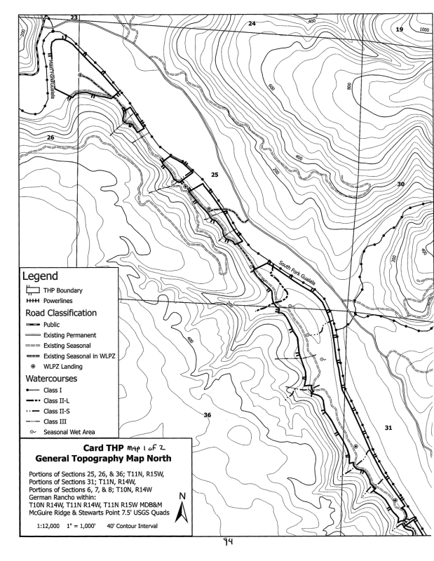
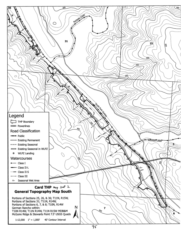
Gualala Redwood Timber’s 167-acre Card Timber Harvest Plan (THP 1-26-00021-SON) is located in the floodplain on the west side of the South Fork Gualala River, from confluence of the North and South Forks, down past Buckeye Creek. The plan was submitted to Cal Fire on February 20, 2026.
This is essentially ‘Dogwood West‘ – the Dogwood THP was entirely in the floodplain on the east side of the South Fork (except for a few acres on the south side of the main stem of the Gualala River). The Card THP is entirely in the floodplain on the west side of the South Fork.
Note: CalFire’s standard procedure is to print out the plan documents, scan them, and post the images to their publicly accessible database, CalTREES. As a result, it is impossible to search for text in the documents, because there are no words in the documents posted, only images of words. In order to make the documents more useful, we have used optical character recognition (OCR) on the documents posted below, so that you can search them.
Card Timber Harvest Plan documents
Card THP Section 1 – [2 MB, 11 pages] Legal description: Cover pages, signatures.
Card THP Section 2 – [14 MB, 102 pages] Operations: Silviculture, yarding, erosion hazard rating, winter operations, roads & landings, watercourse & lake protections, alternative watercourse & lake protections (in lieu of standard rules), biological resources, maps.
Card THP Section 3 – [3 MB, 24 pages] Supporting materials: General site description, analysis of alternatives, discussion and justification of in-lieu and/or alternative watercourse and lake protection practices, cultural resources.
Card THP Section 4 – [20 MB, 153 pages] Cumulative Impacts: Past, present and future projects, assessment of cumulative watershed effects, soil productivity, biological resources, recreational, visual, traffic, greenhouse gas impacts, wildfire risks.
Card THP Section 5 – [19 MB, 126 pages] Attachments: Including soil erosion hazards, Erosion Control Plan, culvert sizing, botanical surveys, geology report, Northern Spotted Owl information, road work.
Card THP Section 6 – [1 MB, 1 page] Archeological information: (confidential)
To download additional documents for this logging plan,
visit the Card THP page on the CalTREES website.
Below are instructions on how to submit comments during the public comment period.
To submit your comments on a logging plan, email your comments to: santarosapubliccomment@fire.ca.gov
or send your comments via U.S. Mail to:
Forest Practice
California Department of Forestry and Fire Protection
135 Ridgway Ave.
Santa Rosa, CA 95401
In the subject line of your email message, or at the top of your letter,
be sure to reference the THP number and name, for example:
THP 1-26-00021-SON “Card”