 Friends of Gualala River Protecting the Gualala River watershed and the species living within it
There’s something exciting to see and do year-round on the Gualala River. Below is information about popular activities to help plan a fun and safe time enjoying the river.
Important Note: Driving in the river bed and on the beaches near the water’s edge is destructive to the river, its wildlife and plants, so please don’t do it.
Please respect private property.
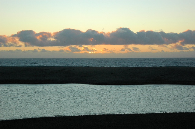
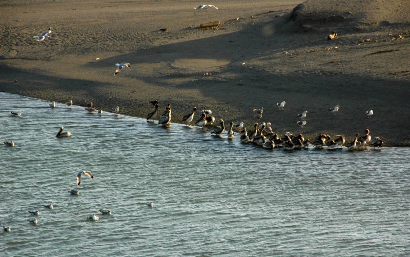
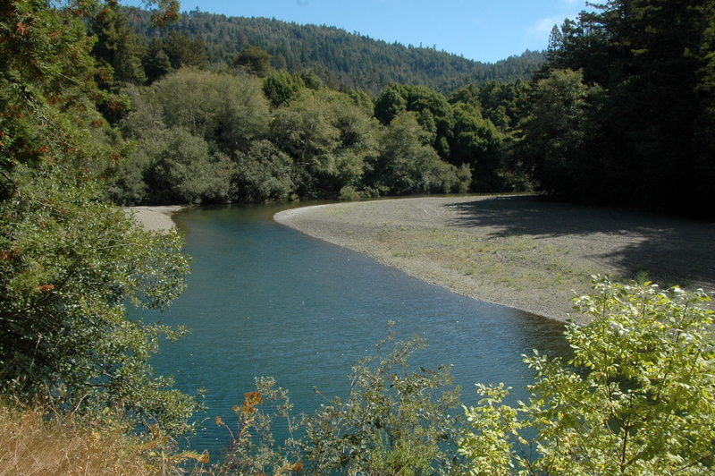
Fun fact: When the mouth of the river is open to the ocean the area near the mouth of the river is called an estuary. When the river mouth is closed it’s called a lagoon.
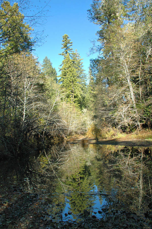
Paddling
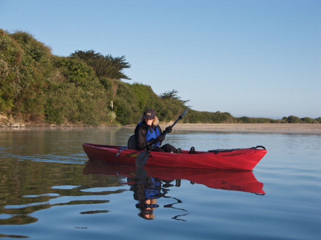
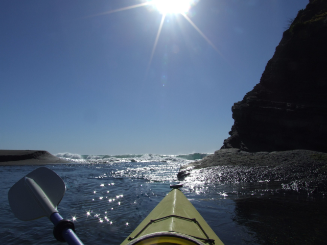
Kayaking, canoeing, and stand-up paddleboarding (SUP) offer front row seats to explore wildlife and plants in and around the Gualala River.
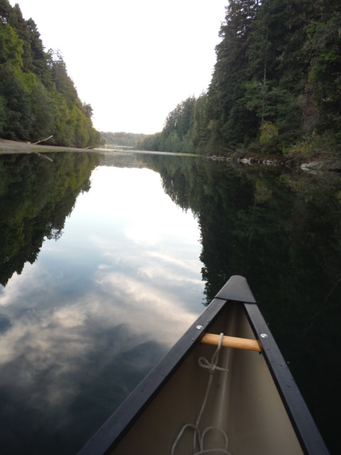
May and June is prime time to paddle the river. The mouth of the river typically closes in the spring and there is usually enough water that time of year to enjoy a leisurely paddle. In summer and fall, when the river’s water level is considerably lower, portaging is required in a number of areas a short distance from the lagoon.
The best time to paddle on the river is usually in the morning when there is less wind. Winds tend to pick-up in the afternoon making paddling more challenging. Morning is also prime time for spotting birds in and around the river. Start your outing by going upriver first, and leisurely exploring as you paddle or drift back down river. There are several gravel bars that make ideal spots to stop for lunch, a rest, or even a swim.
The Mill Bend and the Green Bridge are the most popular and accessible spots to put in a boat or SUP. The Mill Bend is located immediately north of the Highway 1 Bridge that spans the Gualala River. A dirt road on the west side of the Highway leads down to the river at the Mill Bend site. The Mill Bend borders the lagoon.
The Green Bridge is accessed by taking Old State Highway on the south end of Gualala for approximately four-tenths of a mile then bearing right on Gualala Road toward Gualala Arts Center. Remain on Gualala Road for approximately 2.1 miles until you reach the Green Bridge.
I kayaked the Gualala several years ago with a group, launching from the Wheatfield Fork at Annapolis Road / Skaggs Springs Rd. It can be tricky, depending on changing conditions of logs, logjams, toppled large willows and alders across the channel, and a boulder barricade (low whitewater falls) downstream of Fuller Creek mouth. Basic advice would be “be prepared for changed conditions.”
Most of the challenging reaches are on the Wheatfield Fork. The mainstem below South Fork (Twin Bridges, Annapolis Rd) is pretty smooth, but it’s a short ride to the mouth. Bottom line: we made it out dry each time. Two visitors who joined us on one trip got dunked. Not fun in February. Water is about 46-48 degrees Fahrenheit, almost always under 50 in February.
Kayaking when most of the high gravel bars are not fully submerged means that river flows are confined to the narrower channel, and are forced to accelerate and at jumps between bars and riffles, with no off-channel escape to quieter water over the bars if there are snags, toppled trees, or log barriers. It also means more frequent scraping bottom over riffles, logs, and boulders.
Kayaking when the river is very high spreads the flows more, with rapid flow over the main channel, and calmer water over some bars. It has risks, too, but I think it’s probably a little easier to kayak when the river is very high, with overbank flows and all bars submerged… with one exception. That exception is the boulder barricade downstream of Fuller Creek, upstream of Patchett Creek. It’s better to beach and portage around it.
One recommendation: virtually make the trip on Google Earth (most recent images) before kayaking, so you can anticipate the channel pattern, narrows, logjams, boulder barricade sequences as much as possible. There are some 2019 landslides with logs (near the boulder barricade) that may not be in the images.
– long-time observer and friend of the Gualala River
Remember to always wear a personal flotation device when paddling the river.
Local Resources: Adventure Rents, 707-884-4386; Gualala Sport and Tackle, 707-884-4247.
Walking and Hiking
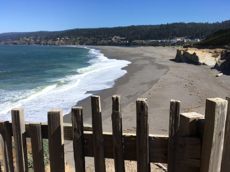
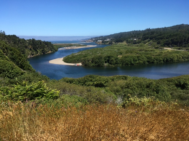
The Gualala Bluff Trail is located right in the heart of Gualala and provides a spectacular view of the Gualala River estuary/lagoon, Gualala Point Park, and the Pacific Ocean. It’s an excellent place to view wildlife as you stroll along or relax on one of several benches. Passing whales, river otters that haul out on the beach, and sea birds such as pelicans, gulls, and cormorants are spotted from the trail at various times of the year.
To access the trail, look for the small monument sign between the Breakers Inn and Sandbar Restaurant at the south end or at the Surf Motel driveway on the north end. There is no river or beach access from the trail. The closest river access points are Mill Bend (see Paddling) and Gualala Point Regional Park.
Visit the Redwood Coast Land Conservancy’s website for more information about the Gualala Bluff Trail.
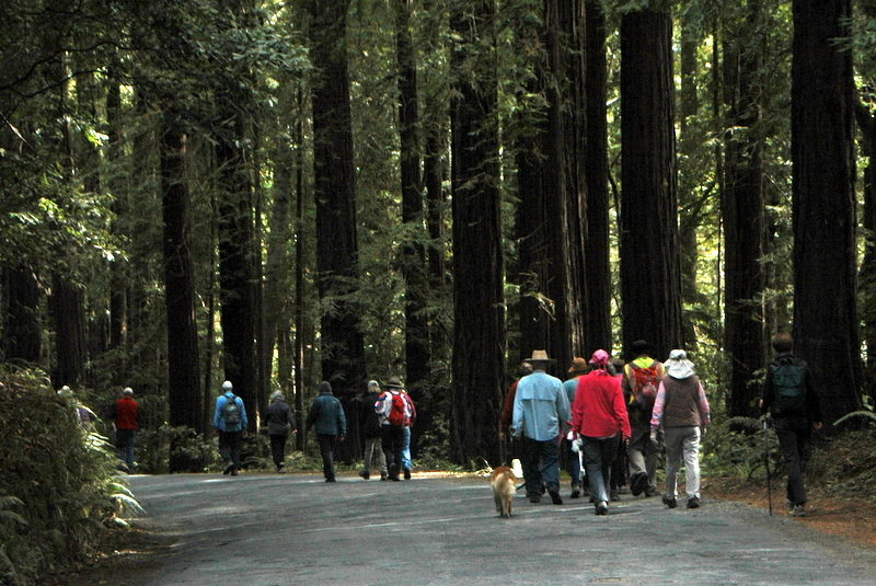
Gualala Point Regional Park, which is accessed just south of the Highway 1 Bridge in Sonoma County, has trails throughout the 195-acre park. The trail system is easy to follow and offers stunning ocean views from bluff tops, paths through meadow and forest, and access to a sandy beach which gives beachgoers the option of enjoying both the ocean and Gualala River.
For a hike along the Gualala River, take the River Trail which connects the Gualala Point Regional Park Campground to the main park. The trail passes under the Highway 1 Bridge where swallows nest in the spring.
A three-mile trail along the headlands connects Gualala Point Park with Walk on Beach in The Sea Ranch.
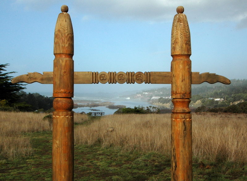
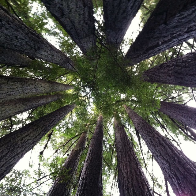
Gualala Arts Center offers a tranquil setting in which to take a short hike. A trail beginning near the bandstand in the picnic area meanders through an enchanting forest that includes majestic Coastal Redwoods with views of the Gualala River from the lower stretch. The trail loops around and ends at the opposite side of the Arts Center near the amphitheater. Although the trail is relatively short it has a few steep areas. Gualala Arts Center is located at 46501 Old State Highway. Take Old State Highway on the south end of Gualala for approximately four-tenths of a mile then bear right on Gualala Road for about one-tenths of a mile. Gualala Arts Center is on the right.
Soda Springs Reserve is located at 24550 Kelly Road in Annapolis approximately 11 miles east of Highway 1/ The Sea Ranch. The 48 acre Reserve offers short hiking trails among majestic redwoods and along Soda Springs Creek. Directions can be accessed via the Sonoma County Regional Parks website.
Resources: Trail maps and more information about hikes within the Gualala Point Regional Park system are available at the Visitor’s Center in the park or by visiting parks.sonomacounty.ca.gov
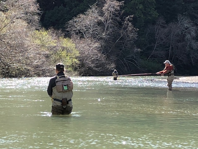
Fishing
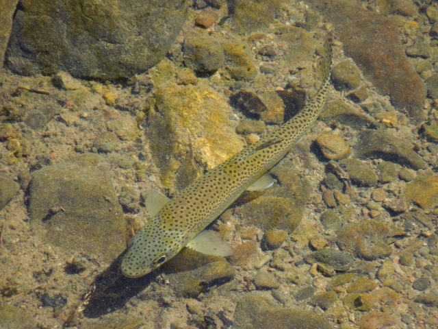
The Gualala River has a long history of attracting fly fisherman from near and far. Whether you fly fish or use a spinning rod, fishing for steelhead on the Gualala River is truly a sport, catch and release of course.
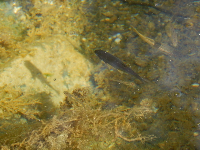
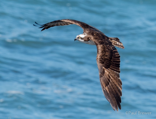
Steelhead, a sea-run rainbow trout, live throughout the river. They need deeply incised holes with cold water where they can grow and avoid predators such as osprey and eagles. When the rainy season arrives and the sand bar opens at the mouth of the river, mature Steelhead swim to the ocean. They return to their home river as adult fish after two-three years where they spawn if river conditions are favorable.
Fishing on the Gualala River is restricted to adequate flows between October 1 through April 30 of each year. California Fish and Wildlife determines if and when the season opens based on the river’s water flow. Anglers should check the Department’s Low-Flow Hotline at 707-944-5533 before going fishing on the Gualala River.
The United States Geological Service (USGS) has current Gualala River flow information posted on their website.
Fishing locations, established by State law, are from the Gualala River mouth to Twin Bridges and Valley Crossing.
Access areas:
- Hwy 1 just north of the river mouth/estuary. Take the dirt road on the west side of Hwy 1 to the parking area near the river. The area known as Mill Bend is owned by Redwood Coast Land Conservancy and open to the public for day use.
- Gualala Point Regional Park and Gualala Point Regional Park Campground provide access the south side of the river.
- Old State Road immediately south of the town of Gualala intersects with Gualala Road which parallels the river’s mainstem on the river’s north side.
- Valley Crossing on Annapolis Road at Twin Bridges, about one mile east of Hwy 1.
Access areas listed above are adapted from locations on CA Department of Fish & Wildlife’s website.
Please respect private property.
Please note that state law requires a valid fishing license and the use of a single barbless hook, catch and release only.
Resources: Gualala Sport and Tackle, 707-884-4247 for fishing licenses and outdoor gear.
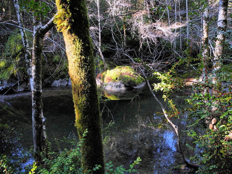
Swimming and Public Access
Any area that can be accessed from the shore with a gentle entry can be a good spot to take a dip. Favorite spots among locals are the Green Bridge (see Paddling section) and Soda Spring Reserve (see Walking and Hiking Section).
East of Stewart’s Point is another spot to access the Gualala River. Although not a good swimming area, it’s a good one for exploring the river and perhaps a picnic. It’s located just past the Haupt Creek Bridge on the Wheatfield Fork along Skaggs Springs Road (before you reach the Annapolis Road Bridge known as Clark’s Crossing). There’s a parking area just before you get to the Haupt Creek Bridge. You can walk down to the river via an access road just beyond the bridge. Please do not drive in the sensitive river bed.
Camping
Gualala Point Regional Park offers camping year-round along the banks of the Gualala River among a mixed forest that includes fragrant California Bay Laurel and Coastal Redwoods. The campground is located just south of the Highway 1 Bridge on the east side across from the Regional Park entrance.
Gualala River Redwood Park is a fully equipped seasonal campground nestled among majestic redwoods with plenty of direct access to enjoy the Gualala River. For more information, visit their website or call 707-884-3533.
Wildlife
This section highlights some, but by no means all, of the wildlife that live in or visit the Gualala River watershed, so be on the lookout while paddling, hiking and exploring. Please remember not to get too close to wildlife — they need space and time to rest.
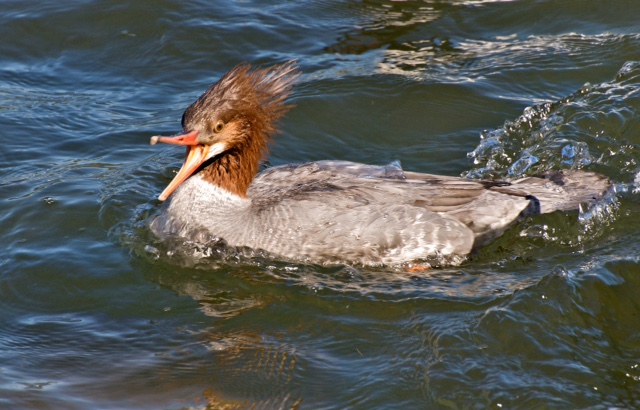
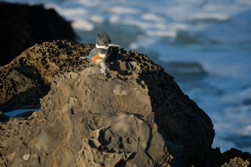
The Common Merganser, a diving duck, is a year round resident of the river. They like to rest on snags in the sun.
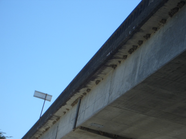
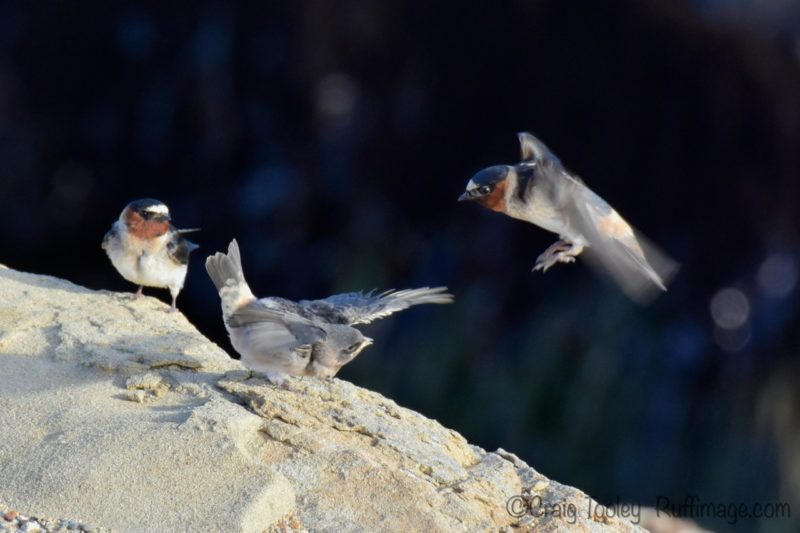
Springtime brings swallows from thousands of miles south to their seasonal home – the Hwy. 1 Bridge that crosses over the Gualala River. Hundreds of Cliff Swallows arrive around the first days of spring and begin building their nests under the bridge where they hatch and raise their young. You can view the swallows in the spring if you paddle the river or walk under the bridge on the park path that connects the Gualala Point Park on the west side to the campground on the east side of Hwy 1.
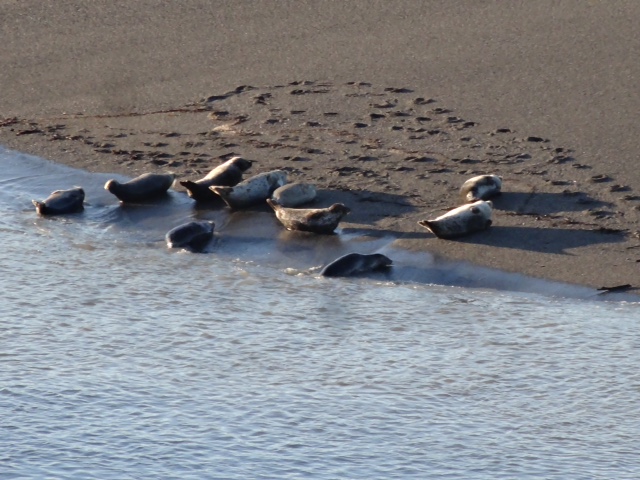
Harbor seals can occasionally be seen hauling out on the Gualala River sand bar (at the mouth of the river) so look for them in the lagoon.
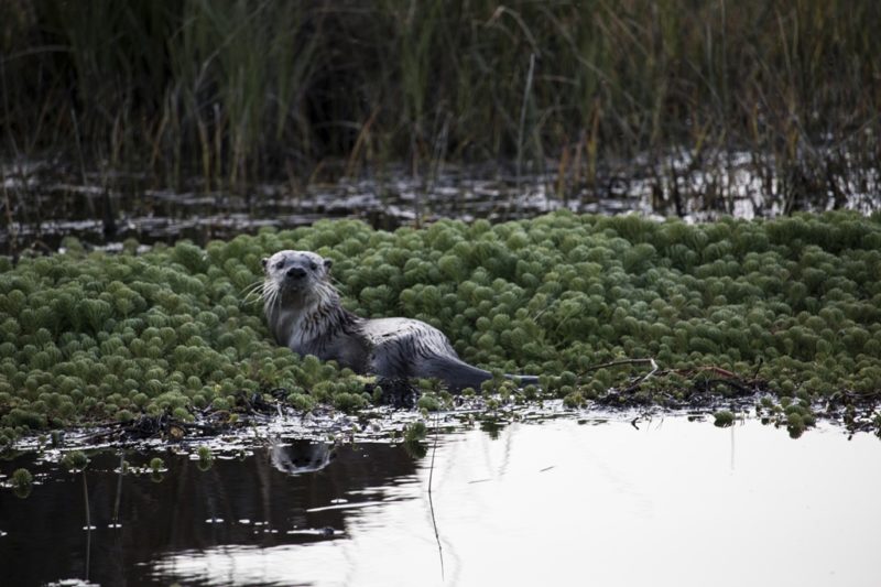
River otters live in the river and, if you’re lucky, can be seen in the river and on the banks.
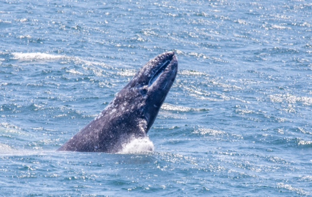
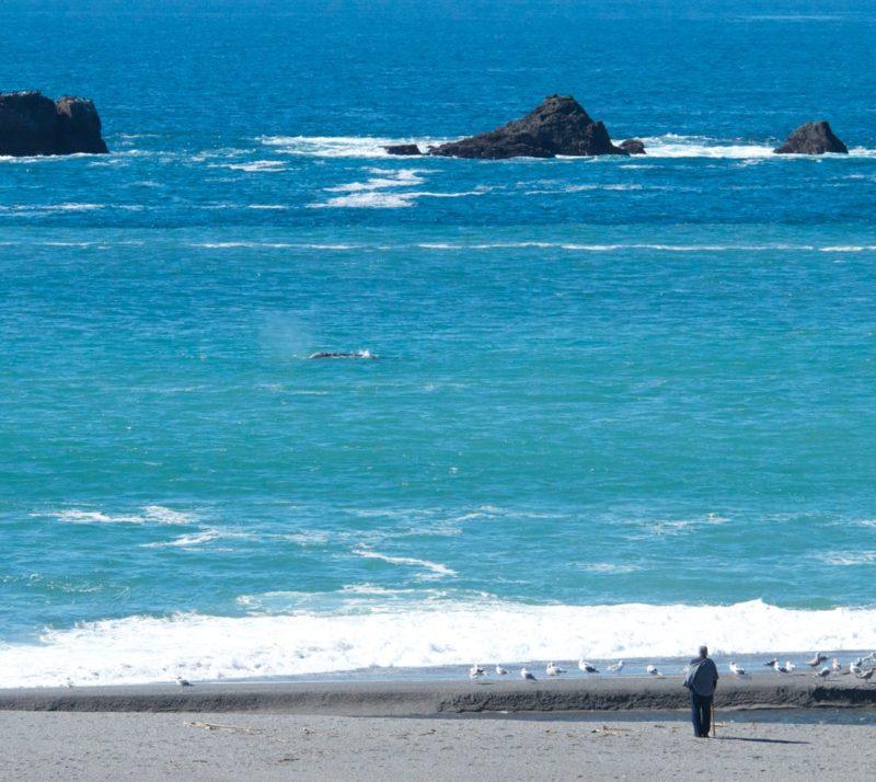
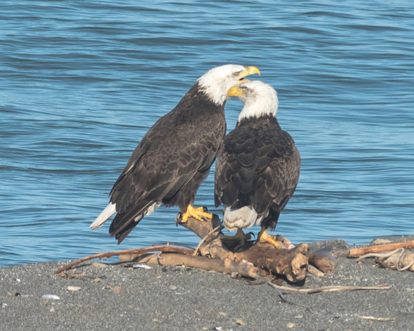
Whales are spotted April through June when they migrate north with their calves. Look for whales near the mouth of the river which provides a fertile feeding ground. It’s also possible to spot resident California gray whales at any time of the year.
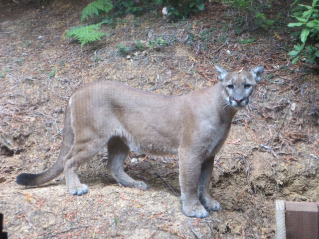
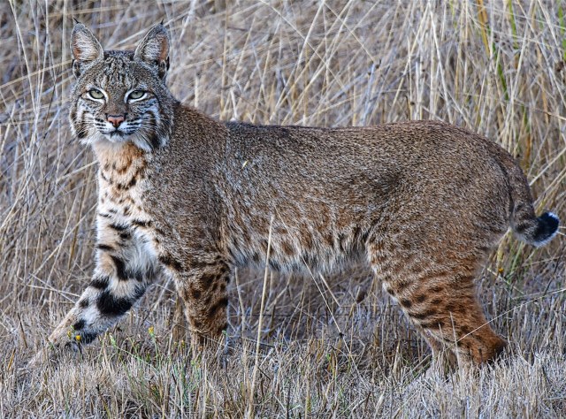
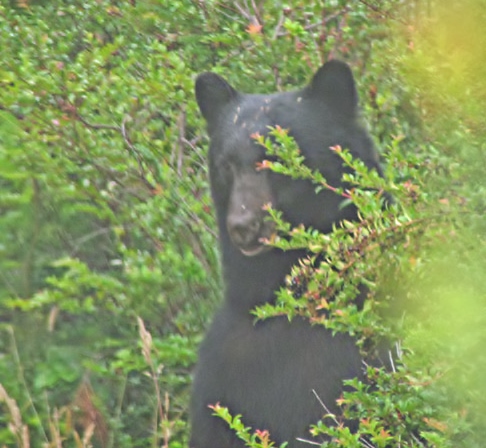
Those who paddle, fish or simply spend time on and around the river have been delighted to see:
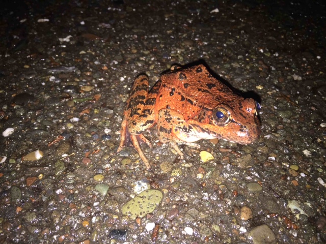
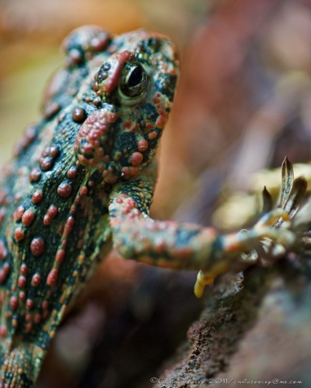
Tiny green tree frogs, red legged frogs, and western toads that live in gravel beds.
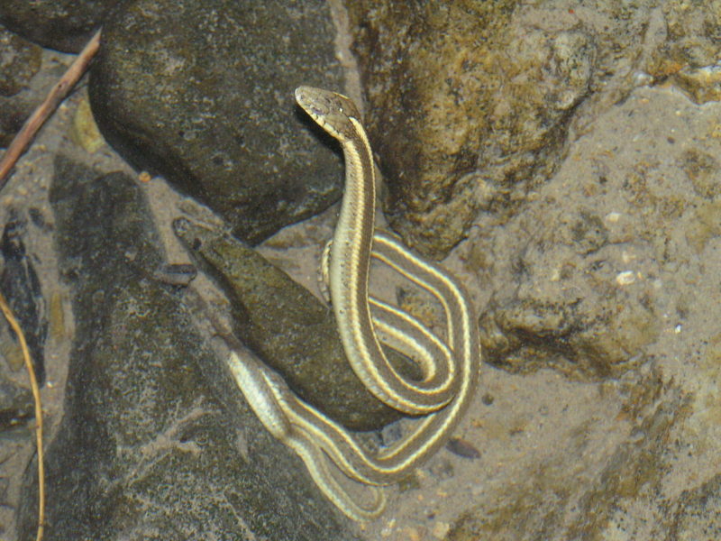
Aquatic Garter Snake (there are no poisonous snakes here along the coast).
And…
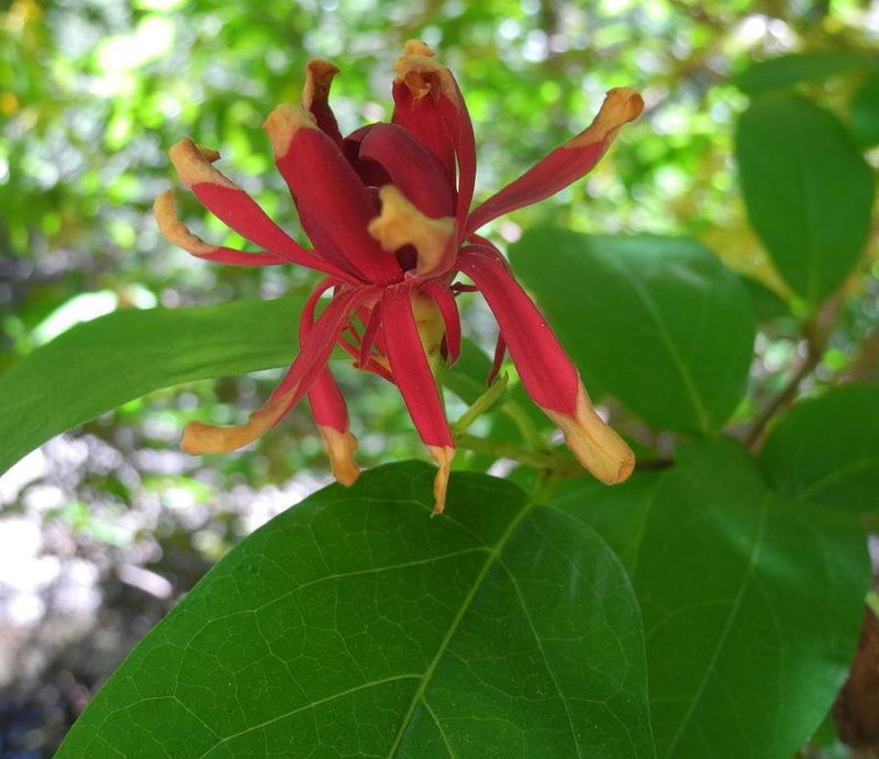
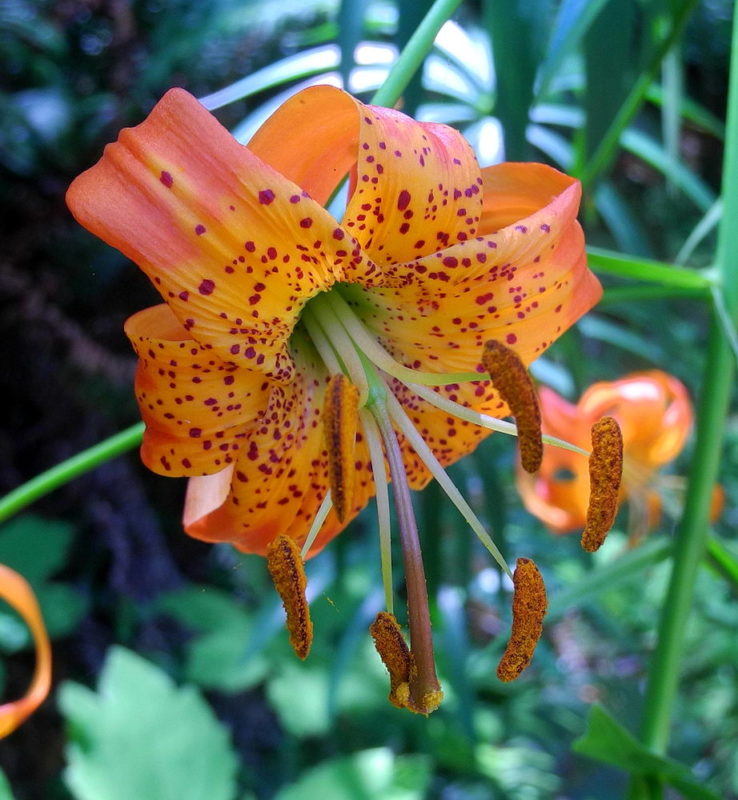
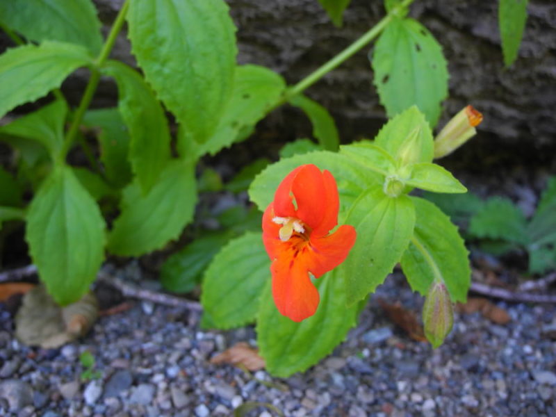
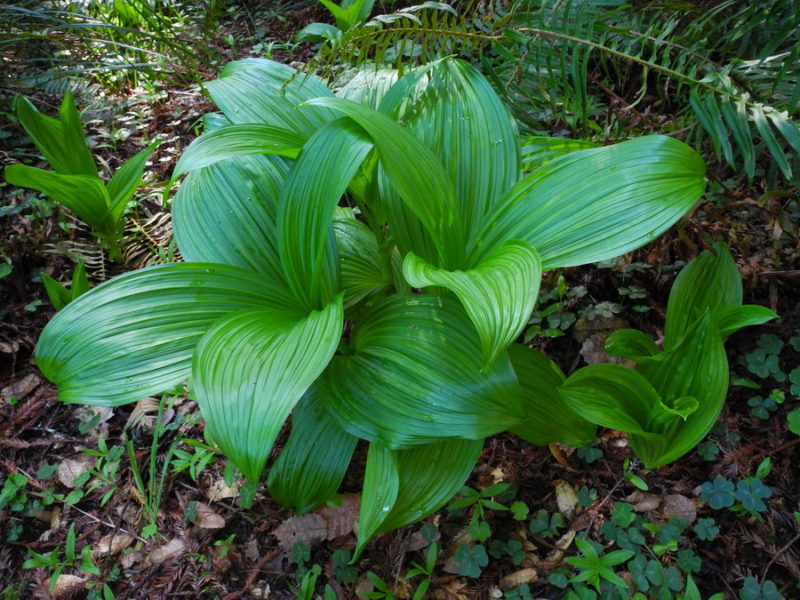
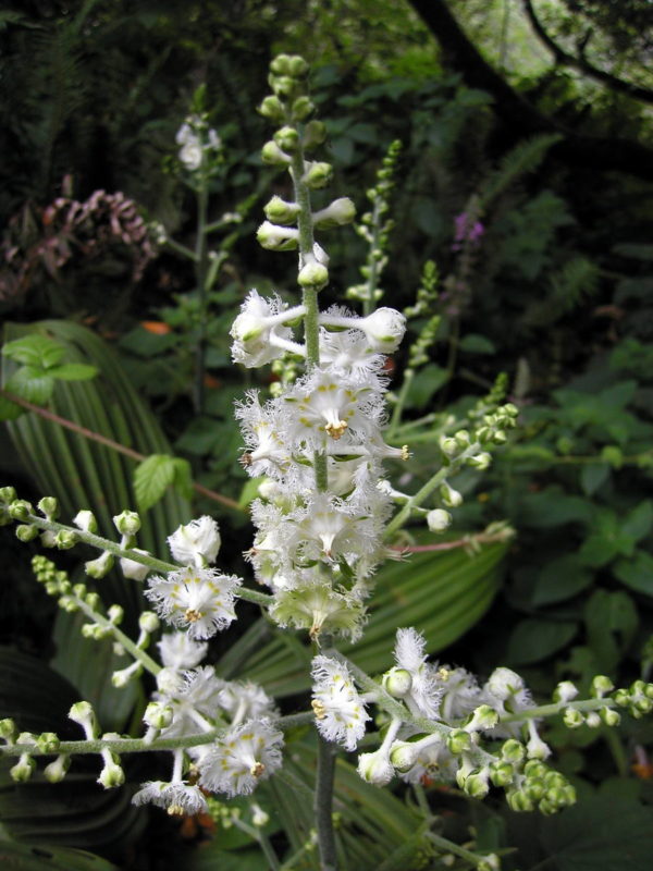
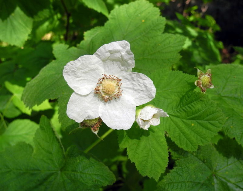
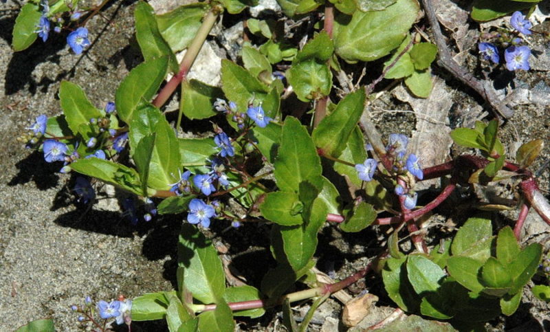
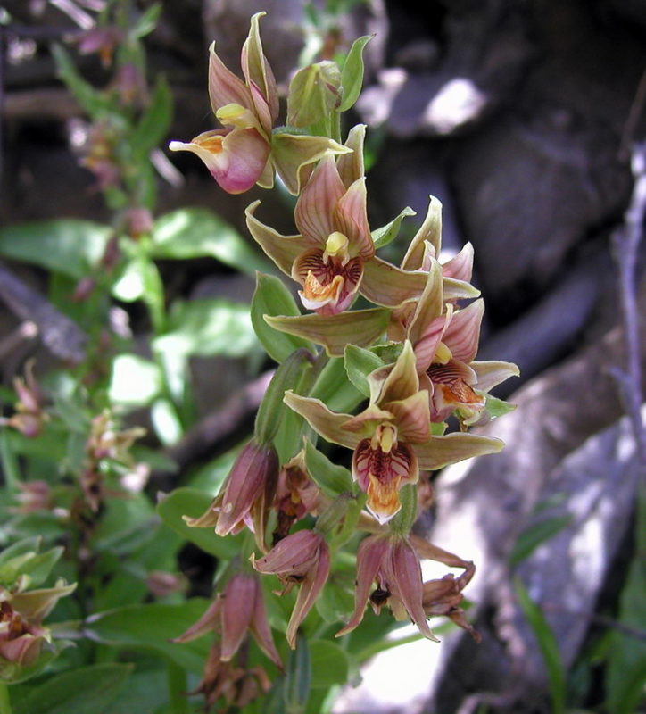
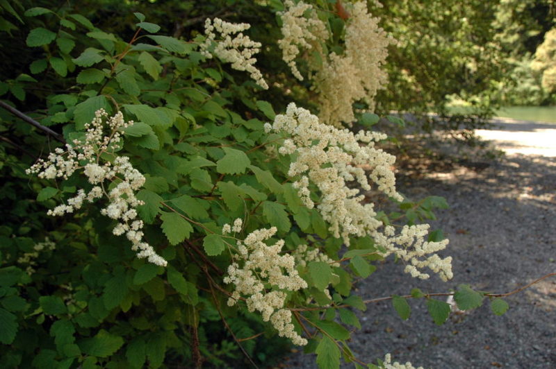
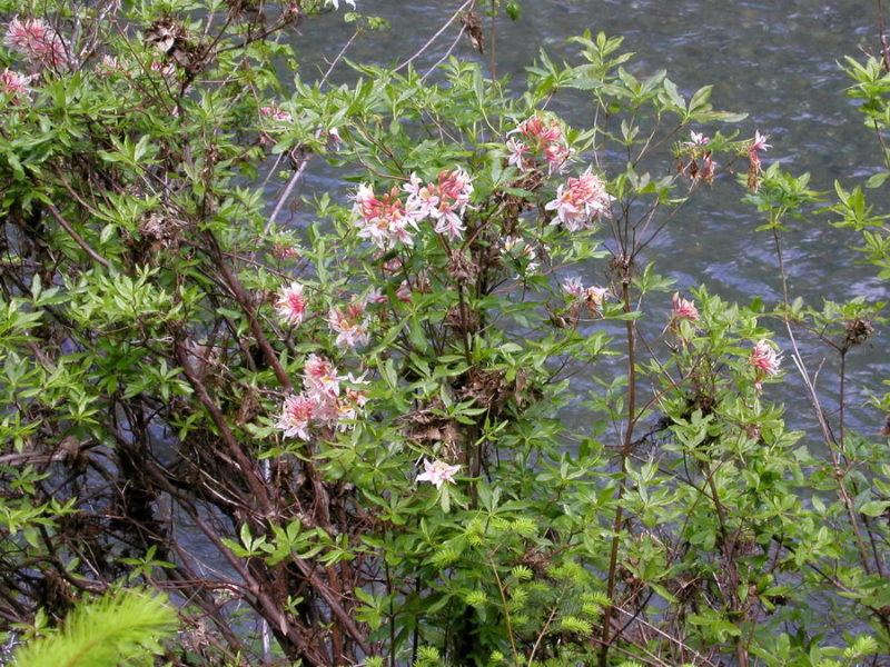
Flowers
The Gualala River watershed nourishes bountiful plant life — way too many to highlight here. A few standouts found along the river include:
Resources: Check out local author Jeanne Jackson’s website for daily nature posts: Mendonoma Sightings.
The Dorothy King Young Chapter of the California Native Plant Society leads native plant walks in the watershed, especially during Native Plant week, typically in April.