Maps of Logging Plans on the Lower Gualala River
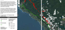
Updated August 12, 2015 Friends of Gualala River hired a geographic information system (GIS) specialist to take the multiple timber harvest plan (THP) maps submitted and make new composite maps that are readable in context of the landscape and past logging. The full extent of the footprint of the logging plans in the lower Gualala … Continue reading Maps of Logging Plans on the Lower Gualala River
Copy and paste this URL into your WordPress site to embed
Copy and paste this code into your site to embed