Friends of Gualala River Protecting the Gualala River watershed and the species living within it
(CDP 55-2006) Proposed construction of a new 285-foot long concrete block retaining wall behind the Surf Supermarket parking lot in downtown Gualala, to connect to an old 105 foot long retaining wall behind the Surf Supermarket itself.
May, 2010 update
The old retaining wall behind the Supermarket failed in 2006, allowing sediment and debris to flow into the Gualala River estuary / lagoon. In April, 2010, Coastal Commission staff recommended replacing the old wall. In May, the Commission approved replacing the old wall, but took no action on proposed new wall.
History
05/2010 Commission approves replacing old wall;
takes no action on proposed new wall
04/2008 Commission finds substantial issue
03/2008 Appealed to Coastal Commission
02/2008 Appeal denied by Supervisors
11/2007 Appealed to Mendocino Supervisors
11/2007 Approved by Coastal Permit Admin.
08/2006 Proposal filed for a new 285-foot wall
Summary
In January 2008, the Independent Coast Observer reported that the applicant has proposed using “polyethene plastic cells… Geoweb®” rather than concrete blocks for a 390-foot retaining structure (105-foot old wall plus 285-foot new wall).
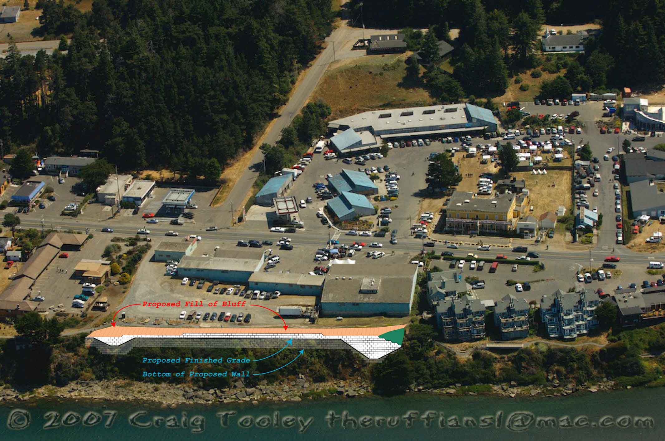
The proposed retaining structure is unnecessary, because the bluff itself is stable.
The current unpaved parking area is composed of un-compacted and unstable fill which is eroding, but that problem could be adequately addressed, and with substantially superior environmental results, by set-back (removal of artificial fill at bluff top), slope adjustment behind the bluff top, minimization of vegetation disturbance, improved vegetation management, establishment of suitable buffers, and proper drainage and runoff treatment of the existing area.
The landowner has explained publicly that this proposal is part of a larger project to demolish existing buildings, create a large paved parking lot, construct new commercial buildings and expand the Surf Supermarket on the bluff overlooking the Gualala River estuary / lagoon.
Since the proposed structure is part of a larger project, reviewing it alone, without considering the potential impacts of the rest of the project, constitutes impermissible project segmentation under the California Environmental Quality Act. The cumulative impacts of the entire project must be considered before a development permit is issued.
The purpose of the proposed retaining structure is to extend the bluff edge further west, in order to gain usable property for future development: to create an enlarged parking lot to serve an expanded supermarket on the adjacent parcel.

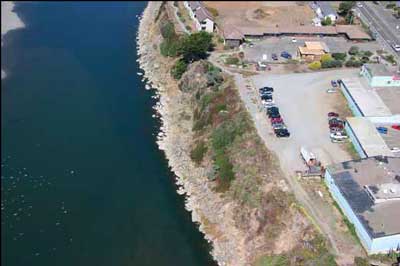
The project as proposed extends towards the lagoon by 6′ to 17′ beyond the crest of the bluff, and would replace the last remaining mature native riparian bluff vegetation, as shown above.
October 8, 2007; photo courtesy of Jamie Hall
The parcel in question is bounded by Highway 1 and the easement for the Gualala Bluff Trail, which extends 25 feet from the bluff edge. The parcel is big enough to serve the current supermarket, but not large enough to serve the proposed supermarket expansion plus additional proposed office space, which would also require parking. Rather than scale the plans to fit the parcel, the applicant wants to enlarge the parcel by encroaching on the neighboring Wild & Scenic Gualala River.
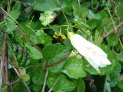
Coastal bluff morning-glory, found on site
Photo by Jon Thompson
Construction of the proposed structure would disturb existing vegetation and soil, making it vulnerable to increased invasion and dominance by non-native plants, reducing native biological diversity (see letters from California Native Plant Society, and botanists Jon Thompson and Peter Baye, below).
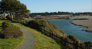
Project construction would also require removal of the Gualala Bluff Trail, destroying years of effort by many local volunteers working with the Redwood Coast Land Conservancy (RCLC). The applicant says that the trail would be rebuilt “to its original specifications” after construction. Volunteers, who have had a contentious relationship with the applicant (who sued the RCLC at one point to stop construction of the trail), are understandably skeptical.

Gualala Bluff Trail
November 2007; photo courtesy of Mary Sue Ittner
The structure would be a visual eyesore. It would be visible from the County Park, including the Gualala Point beach, and from the estuary (lagoon). The Park is visited by many thousands of people every year, including both local residents and visitors to the area.
 The natural beauty of the bluff would be permanently damaged by an ugly concrete block retaining wall.
A retaining structure constructed with Geoweb® would be less aesthetically damaging than concrete block, but the potential loss of native vegetation would still cause irreparable environmental and aesthetic harm.
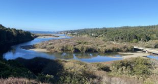
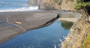
The Gualala River estuary, which forms a closed lagoon during most of the year, is being impacted by run-off of both sediment from the current unpaved parking lot and from toxic urban waste from the downtown area. In order to properly evaluate potential future impacts, and to ensure that the pollution is reduced and the estuary protected, this project must be reviewed in its entirety.
Because of the potential impacts, both aesthetic and environmental, which are not fully mitigated in the current project proposal, a Negative Declaration is not appropriate.
When a complete application is received which discloses the entire project, then an Environmental Impact Report should be prepared to analyze the numerous potential significant impacts of the project. The Report should include an independent engineering review of the justification for and possible less harmful alternatives to the proposed retaining structure.
The current application, CDP 55-2006, should be denied.
California Coastal Commission
March 2008
- Appeal A-1-MEN-08-015
 4.3 MB pdf
Coastal Commission Staff Report - Appeal to the Coastal Commission 60 KB pdf
by Environmental Commons,
Friends of the Gualala River et alFebuary 2008 - Letter from the Coastal Commission 44 KB pdf…parking near the bluff edge is not an authorized use of the site and thus, does not constitute “existing development” as contemplated by LUP Policy 3.4-12 and Coastal Zoning Code Section 20.500.020(E)(1). Moreover, the LCP clearly does not allow the construction of seawalls/retaining walls to facilitate future parking for commercial development…
Letters to the Editor, Independent Coast Observer
Febuary 2008
- The Surf project – editorial, by Peter BayeThe ICO’s editorial on “The Surf project” (February 15, 2008) is right about the benefits of a new downtown building layout that opens up coastal views. But it misses the point entirely about the nature and problems of “piecemealing” the bluff project ahead of the rest of the Surf Project . . .January 2008
- Parking lot wall, by Karl AndersonWith his new proposal John Bower would seem to acknowledge that a large concrete wall in the Gualala River estuary would be an eyesore. But his “soil retention wall” ignores the fact that the bluff is stable and does not need to be retained . . .
- Piecemealing, by Peter BayeWhat’s in a name? Will something called a “soil retention system” rather than a “retaining wall” conserve the natural, mature coastal bluff vegetation along the river bank? In a word, no . . .
- Questions on Gualala bluff structure, by Britt BaileyThere are a myriad of opinions with respect to Mr. John Bower’s proposal to build a retaining wall or retaining structure on the bluff in Gualala. Speaking for Environmental Commons, I’d like to clarify our reasons for opposing and appealing the project to the Board of Supervisors . . .
Letters to the Mendocino County Board of Supervisors
Febuary 2008
- California Native Plant Society 32 KB pdf
- Environmental Commons 52 KB pdf
- Mary Sue Ittner 32 KB pdf
- Redwood Coast Land Conservancy 32 KB pdf
attachment: History of the Gualala Bluff Trail 44 KB pdfJanuary 2008 - Frank Drouillard, civil engineer 44 KB pdf
Letters to the Mendocino County Planning Department: Coastal Permit Administrator
November 2007
- California Native Plant Society 76 KB pdf
- Jon Thompson, botanist 532 KB pdf
- Peter Baye #2, botanist 280 KB pdf
- Mary Sue Ittner 456 KB pdf
- Frank Drouillard #2, civil engineer 860 KB pdf
- Friends of the Gualala River 28 KB pdf
- Environmental Commons 100 KB pdf
- Julie Verran htmlOctober 2007
- Frank Drouillard #1, civil engineer 32 KB pdfJanuary 2007
- Peter Baye #1, botanist 484 KB pdf
More information
November 2007
- Part 1 8.2 MB mp3
- Part 2 8.2 MB mp3
- Part 3 6.3 MB mp3October 2007
- Mendocino County Planning Department: Coastal Permit Administrator staff report 1.4 MB pdf
Photo Tour
from Peter Baye’s Nov. 2007 letter

General appearance of cliff outcrops and coastal bluff vegetation west of the project area, where wave energy (erosion of cliff toe) is higher. Note stratified bedrock outcrops, and patchy fine-grained mosaic of coastal bluff vegetation in upper half of profile.
October 8, 2007; photo courtesy of Jamie Hall
So-called “existing development” of dirt parking lot mid-day on weekday. Note excess capacity of parking lot that is closed to public parking; private parking only. Most cars are parked at edge of floating trail easement. Note concentration of mature bluff vegetation patches.
October 8, 2007; photos courtesy of Jamie Hall

Mature woody coastal bluff vegetation below parking lot, site of proposed retaining wall and artificial “California Random Stone” stained for esthetic mitigation. Sandstone slabs are from natural erosion of cliff.
October 1, 2007; photo courtesy of Peter Baye

Example of long-stable, mature, wind-sheared coastal scrub stand (Baccharis pilularis, bonsai-like Pinus muricata, and Garrya elliptica) in project area, established in fractured bedrock. This mature woody vegetation structure and mass cannot be replaced above or below ground.
October 1, 2007; photo courtesy of Peter Baye

West end of project area, showing extensive spread of mature woody vegetation mantle of the bluff. The spreading, near-prostrate shrubs span the bluff. Damage to portions of the spreading shrubs would likely kill the entire shrub mass. Trunk/root locations were not assessed in the 2007 BioConsultant report. This slowly developed, mature vegetation structure cannot be replaced; nor can its visual character.
October 1, 2007; photo courtesy of Peter Baye

Shallow debris slide of oversteepened, poorly drained past artificial fill, east of proposed retaining wall (separate proposal). Note weed dominance of disturbed sediments.
October 1, 2007; photo courtesy of Peter Baye
 of project area, photo courtesy of Peter Baye")
PVC pipe adjacent (west) of project area, apparently unauthorized. Source of discharge is unknown. Cumulative impact of this point source and nonpoint sources of discharges to the lagoon were not addressed at all in the Staff Report.
October 1, 2007; photo courtesy of Peter Baye