Friends of Gualala River Protecting the Gualala River watershed and the species living within it
| This article was published in the Independent Coast Observer on April 19, 2002. |
Courtesy Independent Coast Observer, Gualala, CA
The community continues to organize against Ric Davidge’s proposal to pump water from the Gualala and Albion Rivers into huge plastic waterbags to be hauled by tug to San Diego.
Friends of the Gualala River held a meeting Saturday night at the Community Center. Tom Cochrane spoke first.
“California water law tends to support transfers of water,” Cochrane said. “We need to concentrate on the effects of taking 20,000 acre-feet out of our river.”
In looking at the draft Gualala River report of the five-agency North Coast Watershed Assessment Report, he found a chart of all existing water permits. They total 4,500 acre-feet for the whole watershed, about three-fourths of which lies in Sonoma County. Total withdrawals are perhaps one-fourth of that, or 1,000 acre-feet.
“Twenty times that is a lot of water,” said Cochrane.
Next, Jim Jordan spoke. He said that Davidge is trying to drive a wedge between the northern and southern parts of the state, but the community need not view it that way. The California Water Plan, the strategy the state has for its water, is being updated and community members can still provide comments, Jordan said.
Water Resources has asked Davidge to submit a plat map of where the water will be used. He has said he wants to change the locations of intakes and mooring facilities, Jordan went on. That means Davidge, or the Michael Baker engineering firm, must redraw the maps of those locations, because he has to specify both the intake points and the points of use to show a beneficial use of water. Jordan said that Water Resources may set a time limit for Davidge to provide these maps.
He added that Roy Austin has done an economic analysis showing that the Davidge project cannot make money at today’s prices. The Norwegian company transporting water from Turkey to Cyprus, a partner in Davidge’s firm WorldWater SA, is losing money. Weather damaged waterbags and the company had to suspend winter operations in 2001.
One example of a government subsidy to the Davidge project, Jordan went on, is that Albany International, the firm Davidge says will manufacture his waterbags, is expert at making very large pieces of fabric, but has never built a waterbag. The federal government is providing $2 million for the Albany International waterbag project. The principal concern is that they don’t know how waterbags will behave in heavy seas.
Peter Baye from Annapolis, who works for the U. S Fish and Wildlife Service but who was speaking as a private individual, advised the community to work on environmental agencies since water law is so complex. He considers the Army Corps of Engineers the key agency, and went over the various outcomes of permit applications to the Army Corps.
To educate themselves on the rules of the game, Baye advised people to study books published by Solano Press of Point Arena, especially their guides to wetlands, the California Environmental Quality Act, and the National Environmental Policy Act. The new editions contain all the case law, he added.
[The ICO checked with Solano Press. The Guide to CEQA 1999-2000 costs $70; The NEPA Book 2001 edition costs $65. Wetlands, Streams and Other Waters is expected to come out in a 2002 edition, and old editions are still available at about $50. For telephone orders call (800) 931-9373, or by email: spbooks@solano.com]
Cochrane came up to talk about geology. Before the meeting he posted a soils map on a side wall of the Community Center, and on the back wall the topographic maps for the whole watershed. Cochrane had marked with red dots the high points over 1,500 feet that collect the rainfall. He said he likes to have such maps on his wall at home.
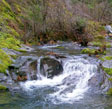
The Gualala River estuary is three miles long from the mouth to the green bridge. The San Andreas Fault controls the lower reaches of the river so that it has a very low gradient, and gravel builds up. It is 10 miles from Valley Crossing to the river mouth.
In the last interglacial period, the sea level was lower and the ocean was three or four miles farther out than today. Since then the sea level has slowly risen.
Cochrane assumes an average 36 inches of rain a year over the 300-square-mile watershed, or 570,000 acre feet of rainfall, but Davidge uses a similar figure for runoff. According to Cochrane, only 60 percent of rainfall runs off year around, and 75 percent in the winter months, bringing runoff down to 259,000 af, or 50,000 af per each of five winter months.
During those months it rains about once a week, so there are roughly 30 days of high flow. According to Roy Austin’s numbers, Davidge can fill four bags a day; 180 af per day on 30 days of high flow comes out to 5,400 af, only a quarter of what Davidge proposes to take. He would have to take out the other 15,000 af on low flow days, 180 af when there is little water in the river.
“What is the effect of that?” Cochrane looks at the Carmel and Salinas Rivers, where salt water intrusion has gone way inland. He predicts that would happen here. In Monterey Bay there was so much water flowing out of the Carmel and Salinas Rivers in the early 1800s that people could dip fresh water out of the bay. Now the anchovies are gone.
“Were they dependent on those fresh water flows?”
Fresh water floats on top of salt water. The salmon and steelhead may need to see [or smell] that plume to get up the river to spawn, Cochrane said.
Earlier, he explained that the umbrella non-profit group for the FOGR is the Redwood Coast Watersheds Alliance. The FOGR started about 10 years ago, and was just Cochrane and Vivian Green, who will now be joined by others in a steering committee. Draft bylaws and a steering committee were approved by acclamation at the end of the meeting.